-
prototype photographs
This section contains a sampling of the hundreds of prototype photographs that I have in my collection. Most are my own; however, I have included credits for those that are not. It has been set up by Subdivision and in geographical order. Although I model 1960, the photos span many decades, however, many remain relevant or at least somewhat interesting.
We are always happy to hear from folks that have access to photos that may be of interest to us. We do not use any photos for commercial purposes and respect all authorship.
-
-
-
boundary subdivision
The Boundary Subdivision is the major focus of the layout and this set of photographs begins at Nelson (M0.0), which was the Division point and main yard, and progresses westward through the Subdivision to the end at Midway (M126.6). The railway follows the Kootenay River west from Nelson, then along the Columbia River, and then climbs above the Lower Arrow Lake and through the Christina Range of the Monashee Mountains. It descends along McRae Creek on the west side of the range, and into the Kettle River Valley where it follows the Kettle River and then the Granby River. After crossing a second summit at Eholt, it descends along the Eholt and Boundary Creeks to reconnect with the Kettle River and into Midway.
This is the main subdivision that is modeled on my layout and each end is connected to a staging yard.
-
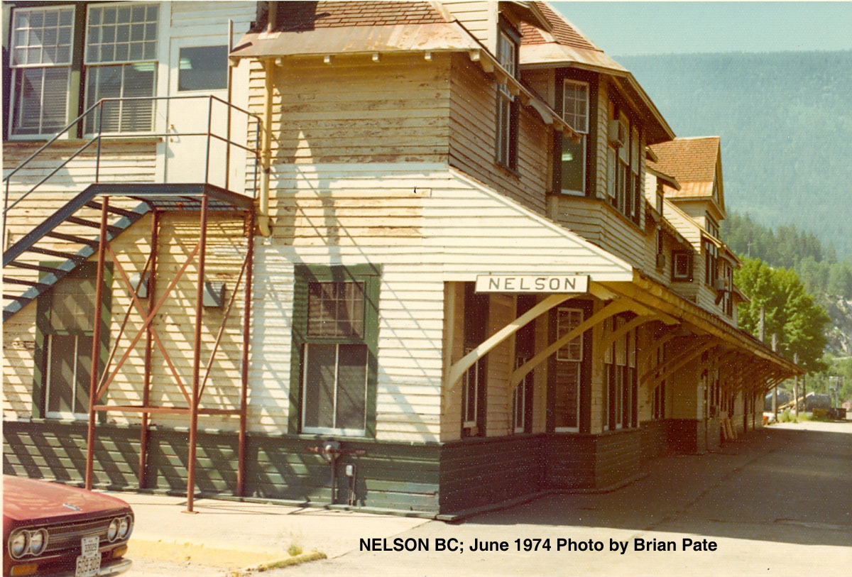
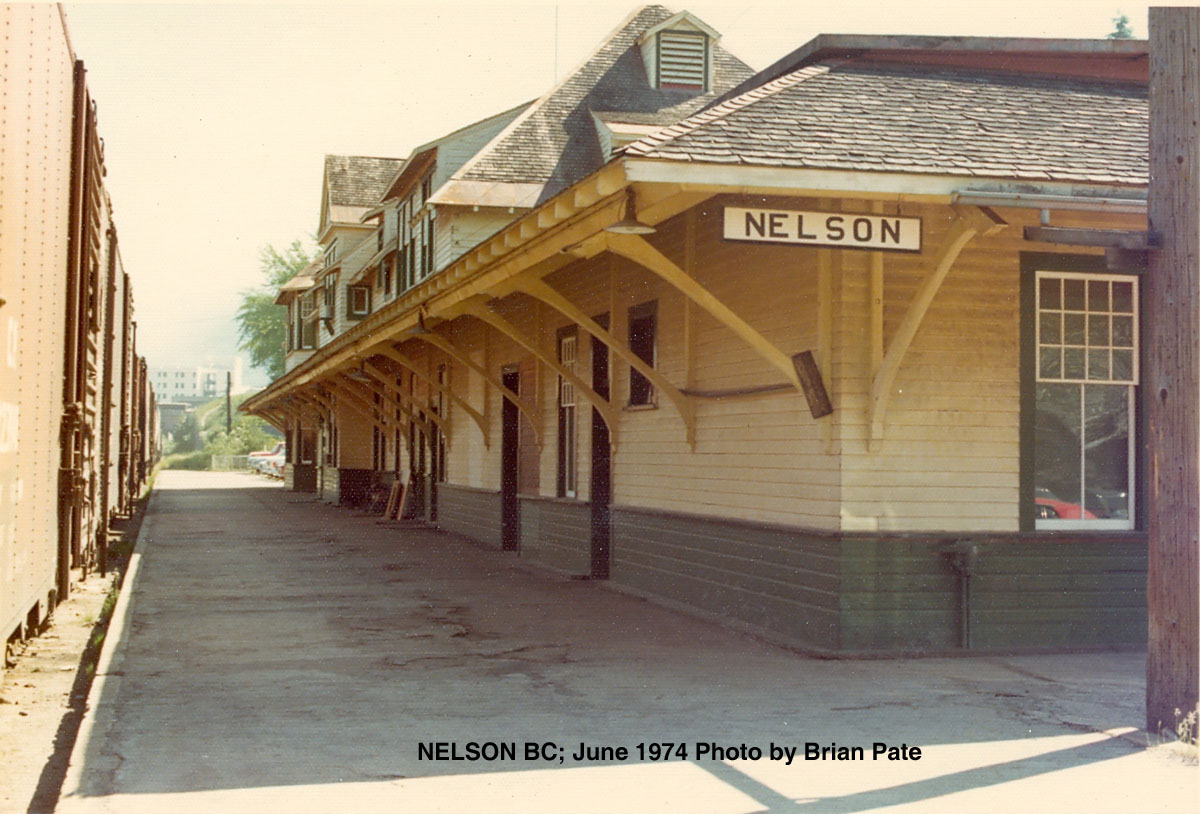
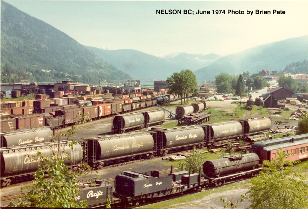
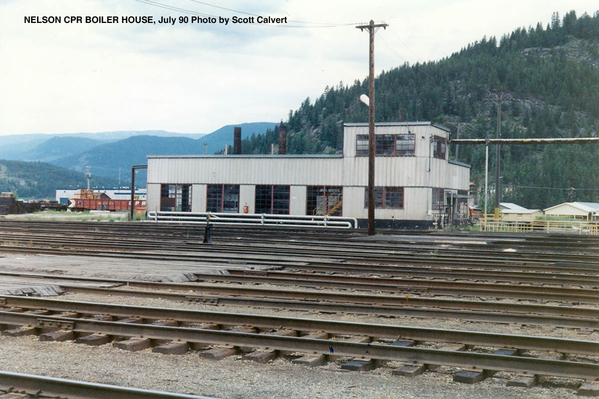
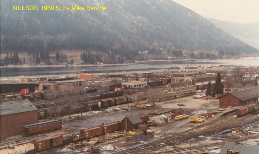
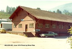
nelson, BC (Mi. 0.0)
-
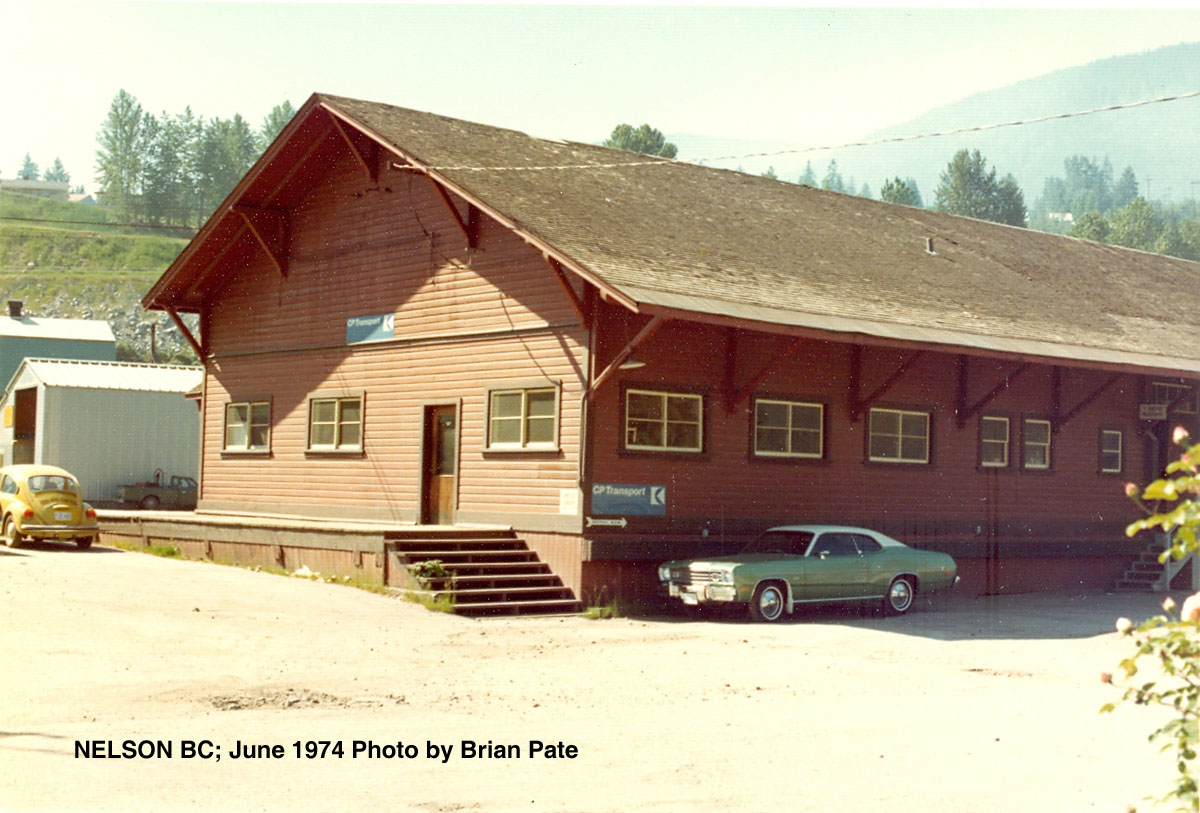
Nelson Shed (June 1974 by Brian Pate)
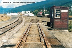
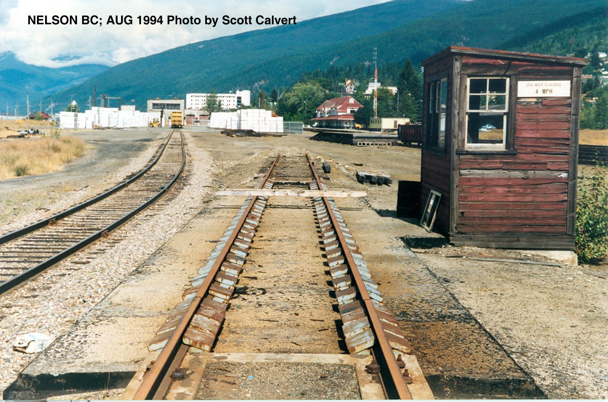
Nelson Scale House (Aug 1994 by Scott Calvert)

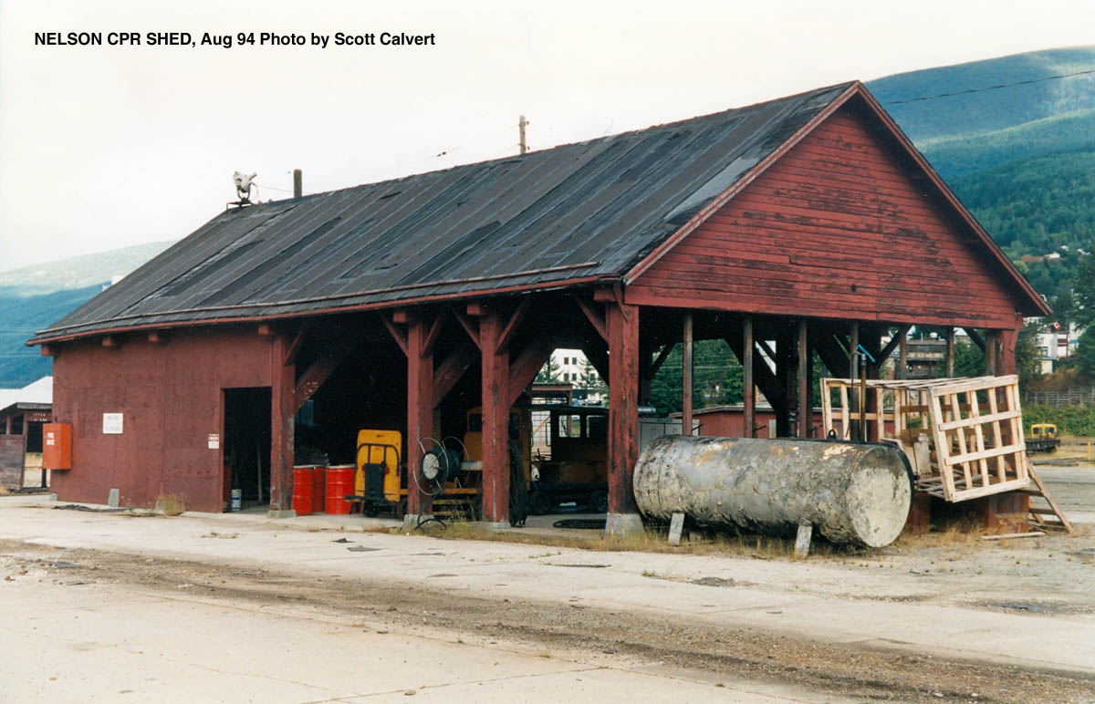
Nelson CPR Shed (Aug 1994 by Scott Calvert)
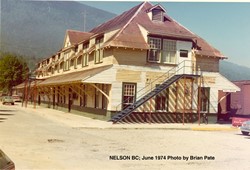
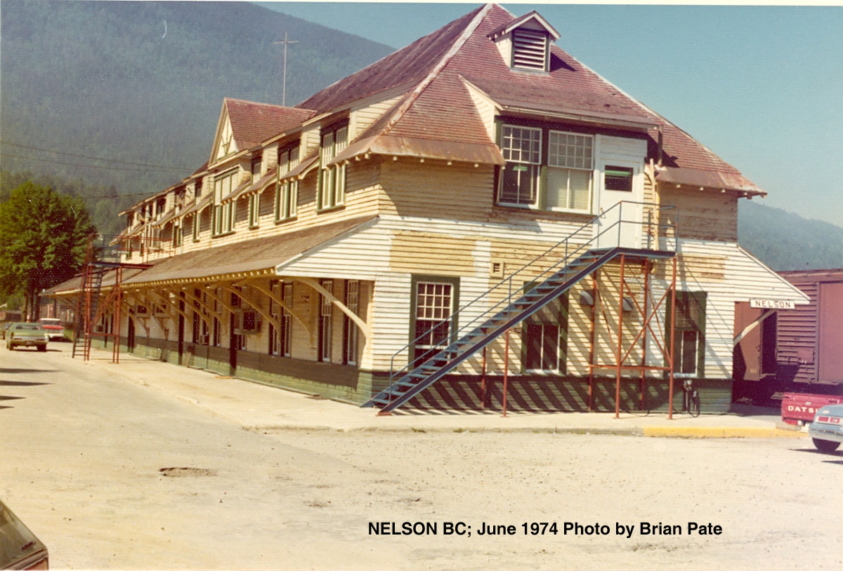
Nelson Station (June 1974 by Brian Pate)
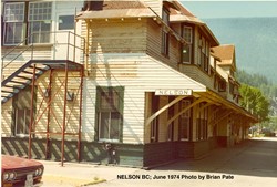
Nelson Station (June 1974 by Brian Pate)
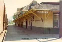
Nelson Station (June 1974 by Brian Pate)

Nelson Yard (June 1974 by Brian Pate)
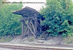
Nelson Ore Loading Ramp (July 1990 by Scott Calvert)
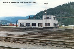
Nelson CPR Boiler House (July 1990 by Scott Calvert)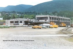
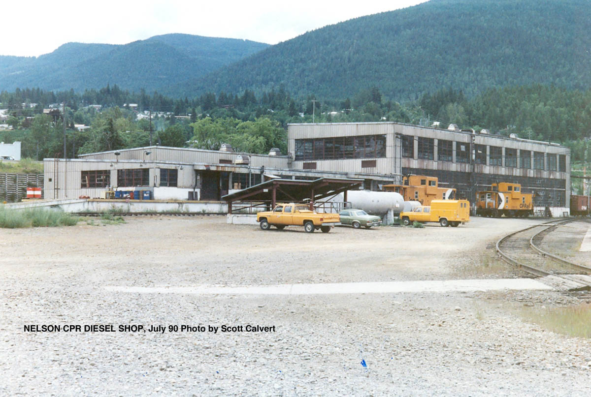
Nelson CPR Diesel Shop (July 1990 by Scott Calvert)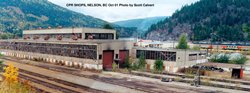
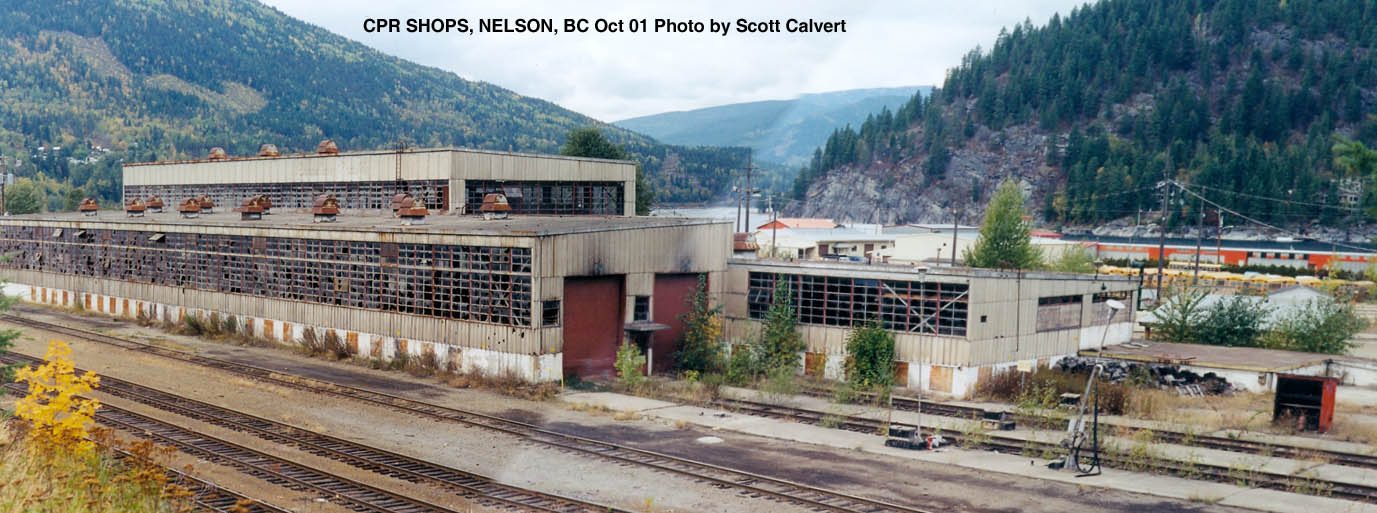
CPR Shops, Nelson BC (Oct 2001 by Scott Calvert)
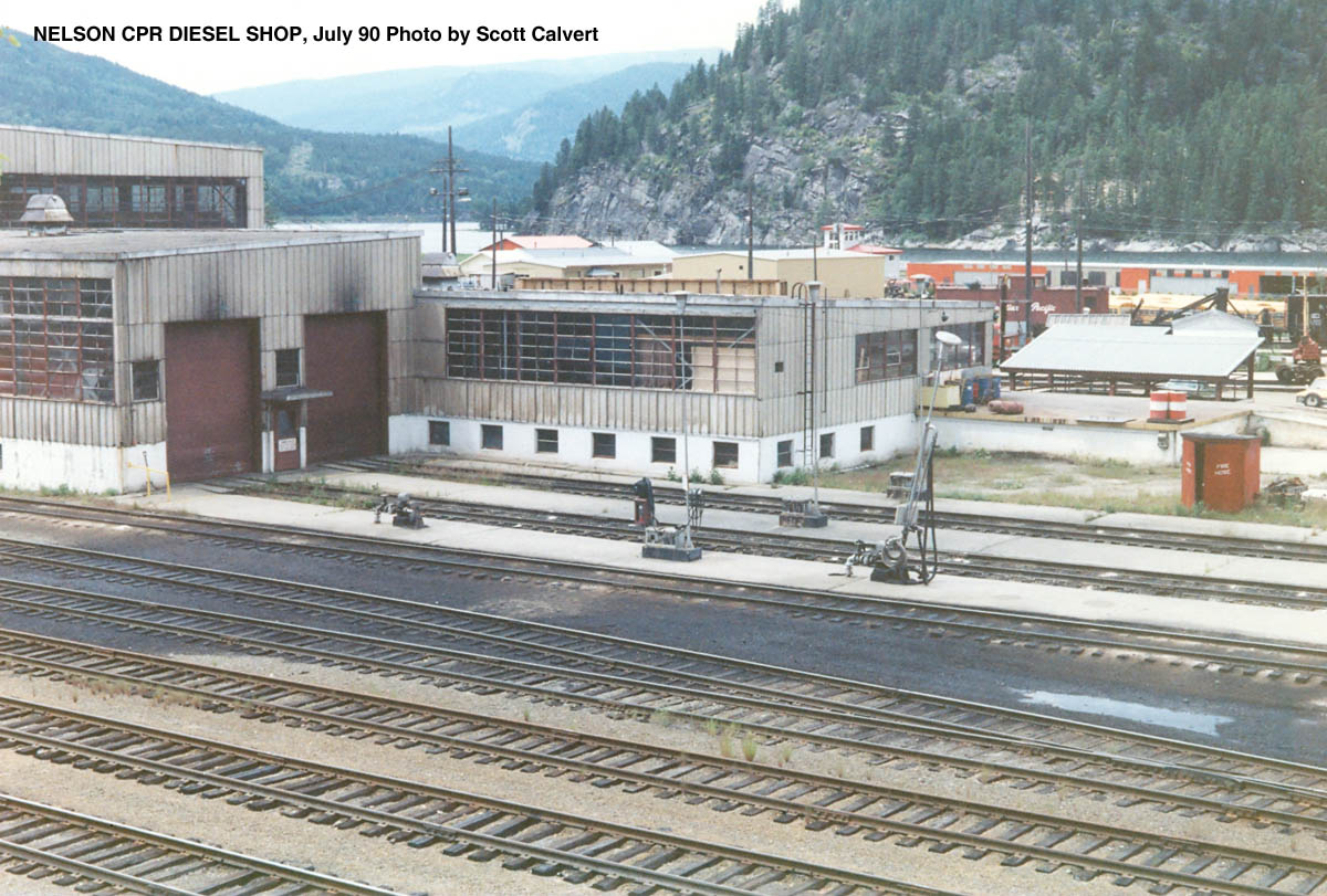
Nelson CPR Diesel Shop (July 1990 by Scott Calvert)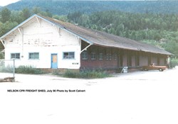
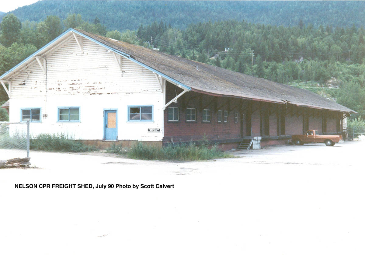
Nelson CPR Freight Shed (July 1990 by Scott Calvert)
-
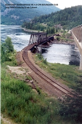
Kootenay River Bridge, BC (Mi. 4.0)
-
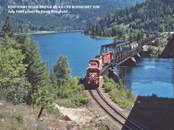
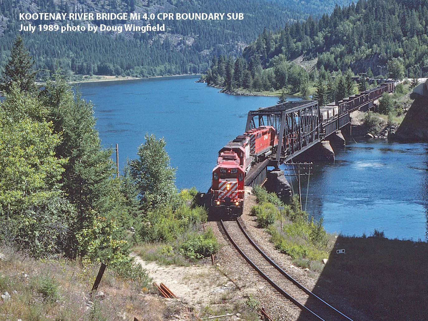
Kootenay River Bridge Mi 4.0 CPR Boundary Sub (July 1989 by Doug Wingfield)
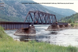
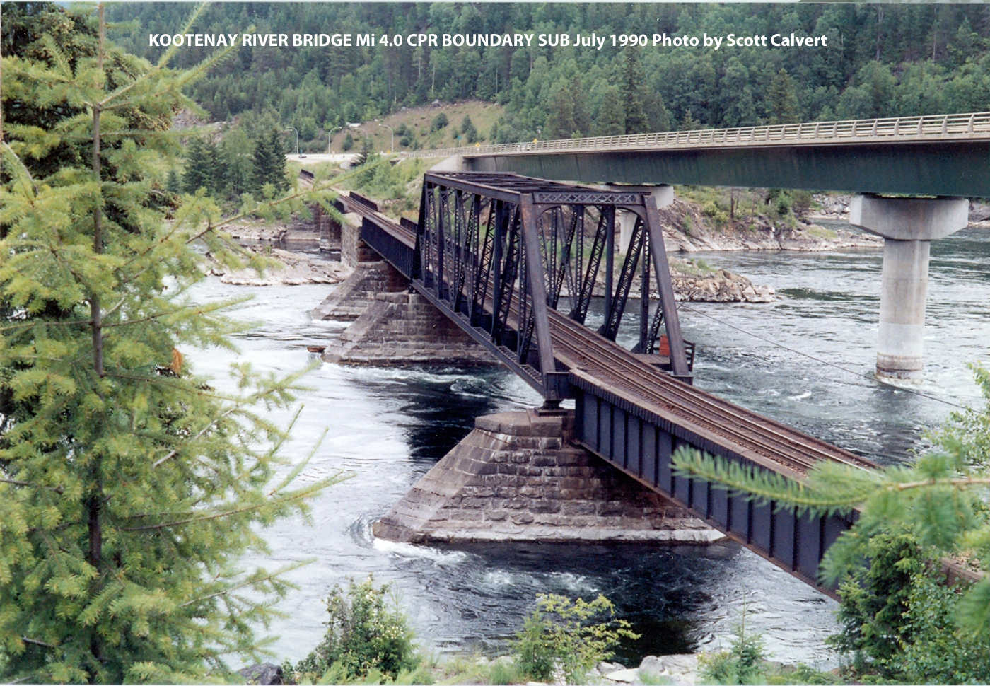
Kootenay River Bridge Mi 4.0 CPR Boundary Sub (July 1990 byScott Calvert)
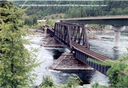
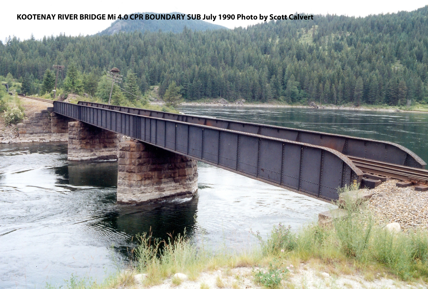
Kootenay River Bridge Mi 4.0 CPR Boundary Sub (July 1990 byScott Calvert)

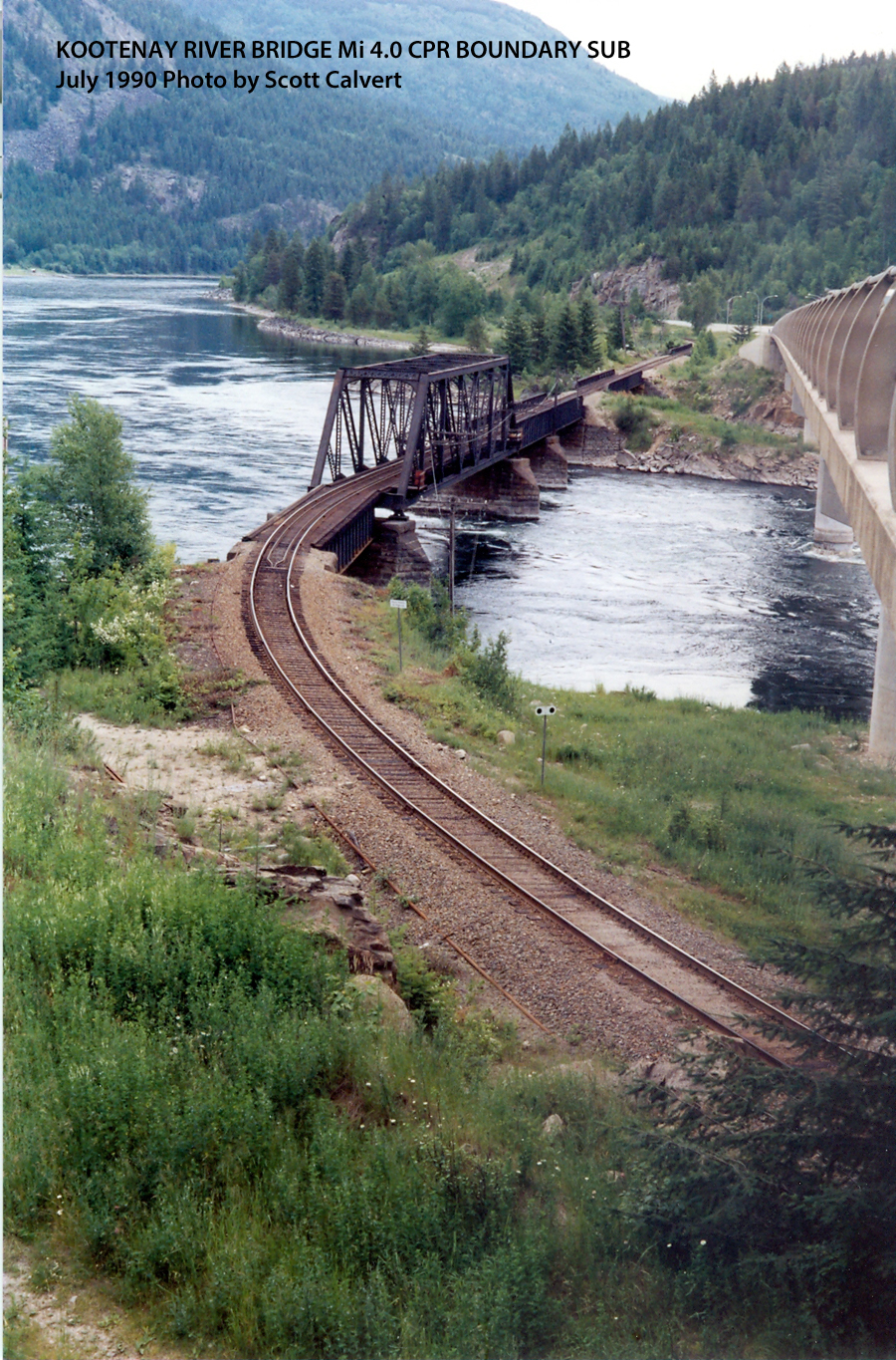
Kootenay River Bridge Mi 4.0 CPR Boundary Sub (July 1990 byScott Calvert)
Kootenay River Bridge Mi 4.0 CPR Boundary Sub (July 1990 byScott Calvert)

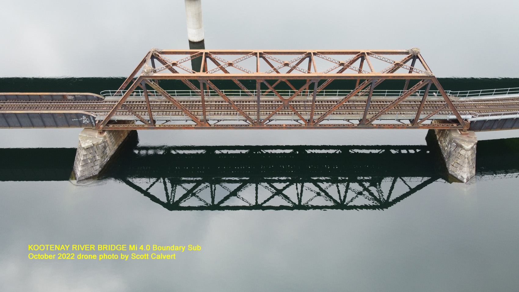
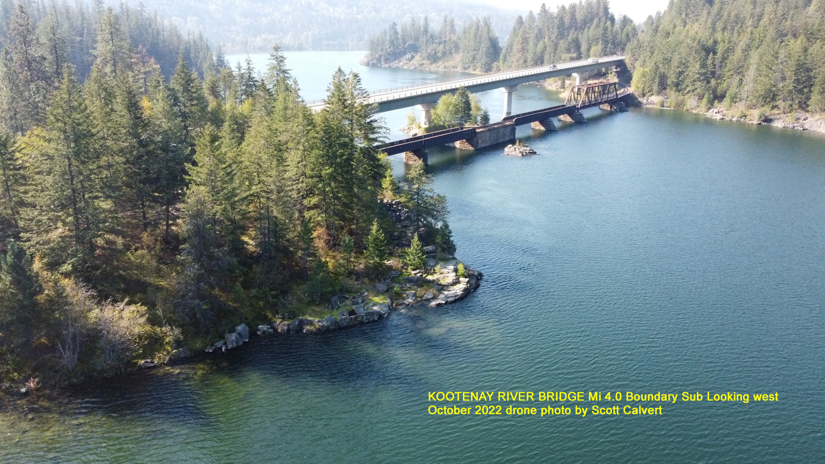
Kootenay River Bridge Mi 4.0 Boundary Sub. October 2022. Drone photo by Scott Calvert.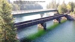 Kootenay River Bridge Mi 4.0 Boundary Sub Looking West. October 2022. Drone photo by Scott Calvert.
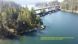
Kootenay River Bridge Mi 4.0 Boundary Sub Looking West. October 2022. Drone photo by Scott Calvert.
-
South Slocan, bc (Mi. 11.9)
-
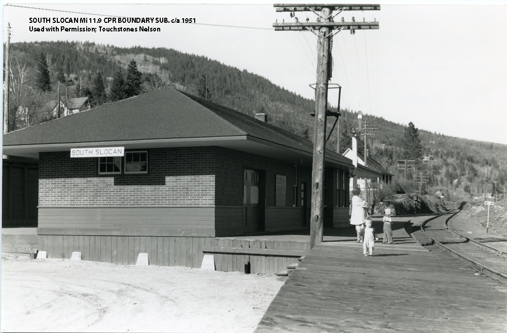
South Slocan Mi. 11.9 Boundary Sub, c/a 1951. Used with permission, Touchstones Nelson.
Touchstones Nelson: Museum of Art and History; Accession No. 96_028_121
Photo shows Audrey Stevenson and sons Monty and Ken at South Slocan station c1951 waiting for passenger train from Castlegar to Nelson, Wilfred Marquis was conductor.

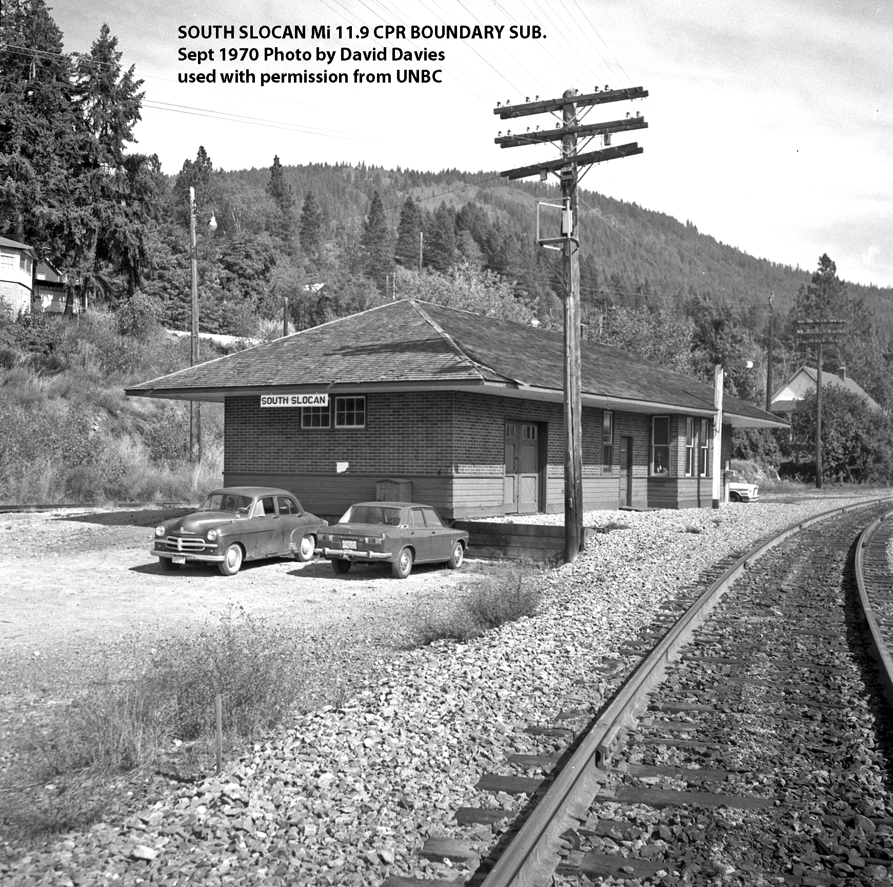
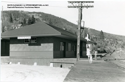
South Slocan Mi. 11.9 Boundary Sub, Sept 1970 photo by David Davies used with permission from UNBC.
David Davies Railway Collection; Northern BC Archives, UNBC Accession No. 2013.6.36.1.028.33
Photograph depicts the South Slocan Junction at mile 11.9 on the CPR line on the Nelson Boundary Subdivision. It closed as an agency in June 1969 but the telegrapher still maintained it. Three to four freights pass per day on the main line: 2 to Trail, 1 to Castlegar pulp mill, and 1 every other day to Midway. On the branch there is 1 train per week to Nakusp that leaves Nelson on Monday, arrives in Nakusp on Tuesday, and returns to Nelson on Wednesday. The view is looking east.
https://search.nbca.unbc.ca/index.php/south-slocan-junction-on-cpr-line
-
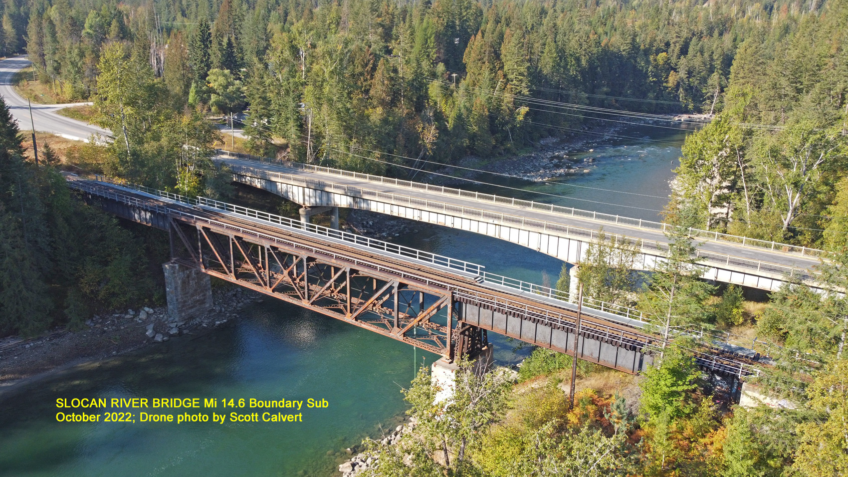
Slocan River Bridge, bc (Mi. 14.6)
-
 Slocan River Bridge Mi 14.6 Boundary Sub. October 2022. Drone photo by Scott Calvert.
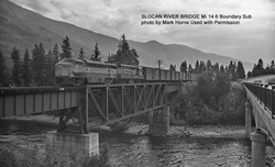
Slocan River Bridge Mi 14.6 Boundary Sub. Photo by Mark Horne, Used with Permission. -
-
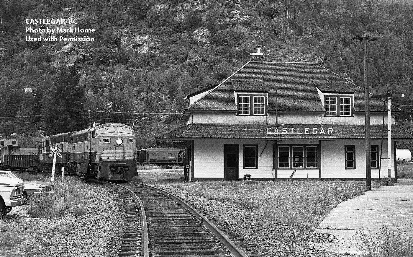
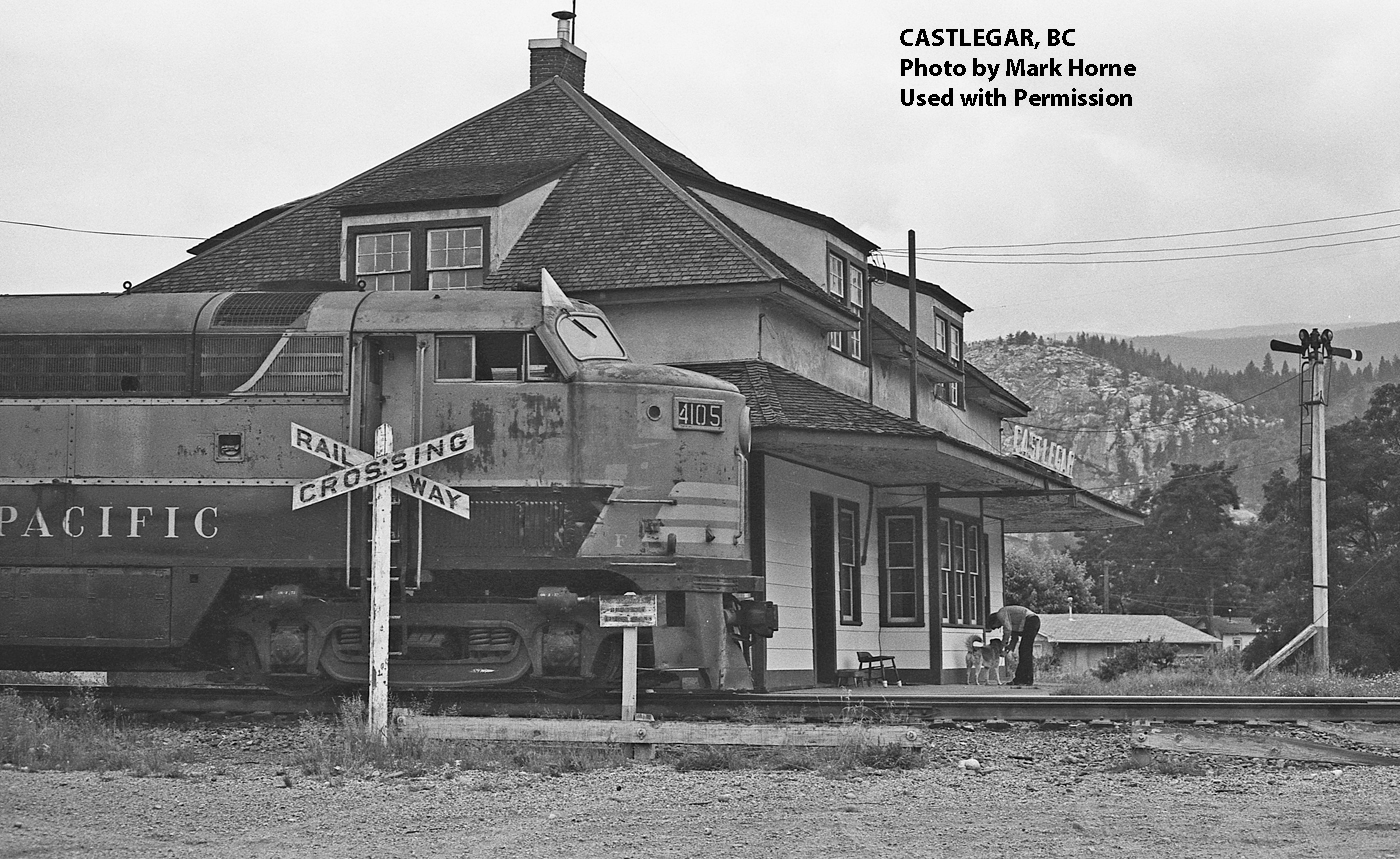
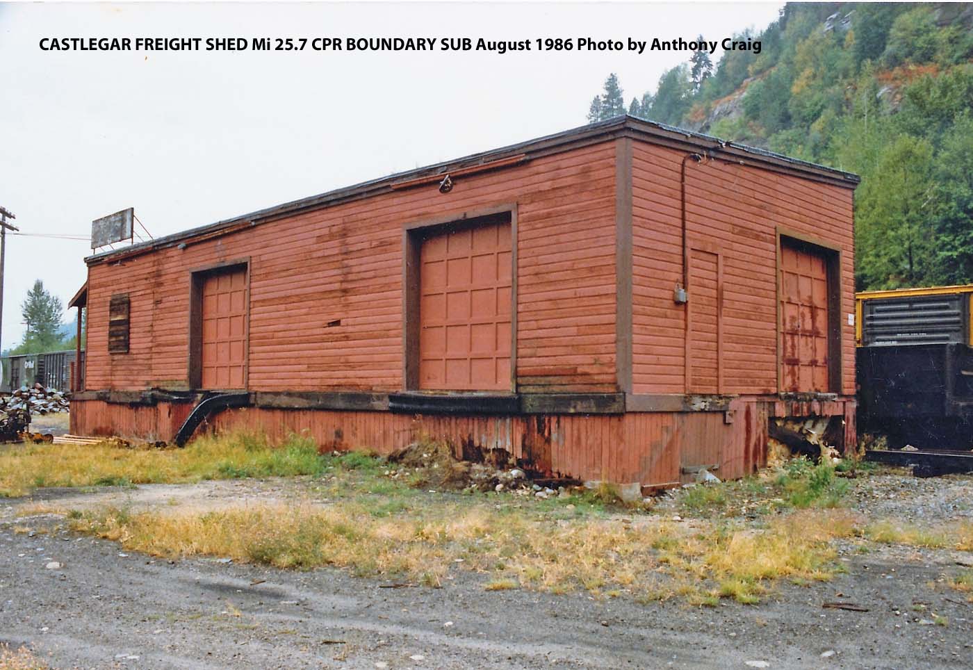
Castlegar, BC (Mi. 25.7)
-

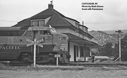

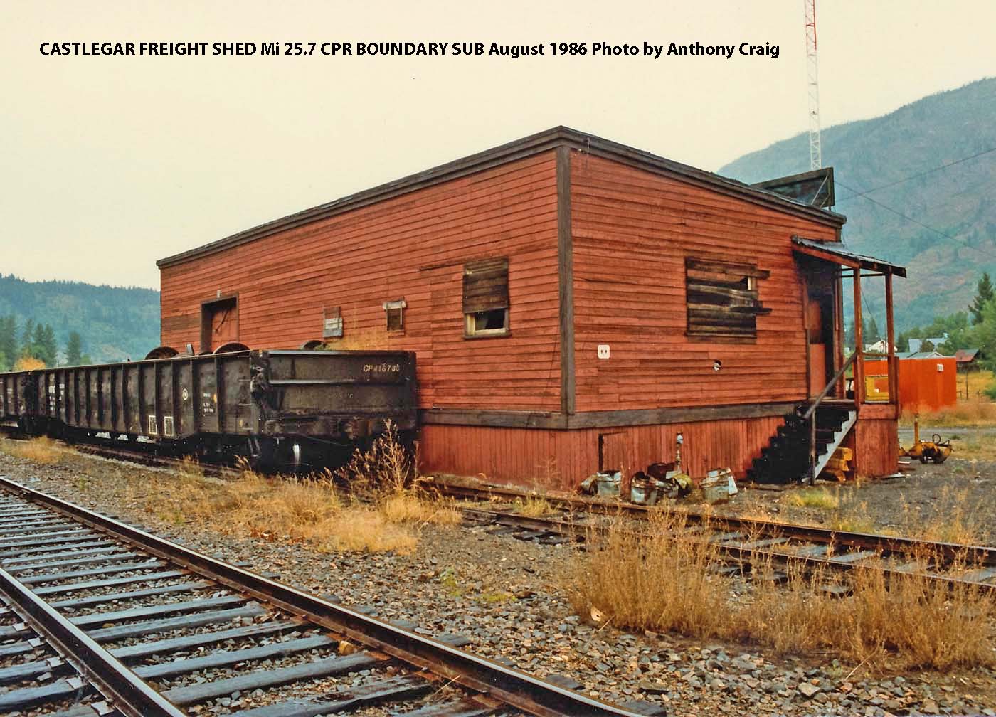
Castlegar Freight Shed Mi 25.7 CPR Boundary Sub (Aug 1986 by Anthony Craig)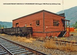
Castlegar Freight Shed Mi 25.7 CPR Boundary Sub (Aug 1986 by Anthony Craig)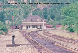
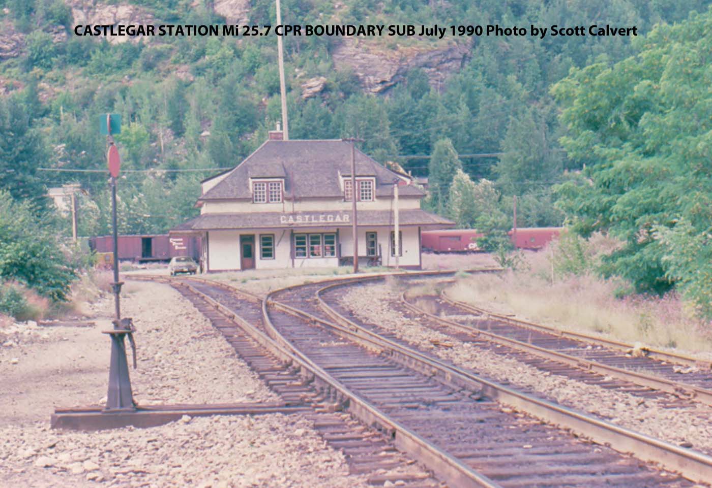
Castlegar Station Mi 25.7 CPR Boundary Sub (July 1990 by Scott Calvert)
-
Mccormack creek bridge, bc (Mi. 36.1)
-
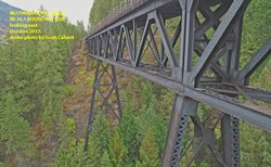
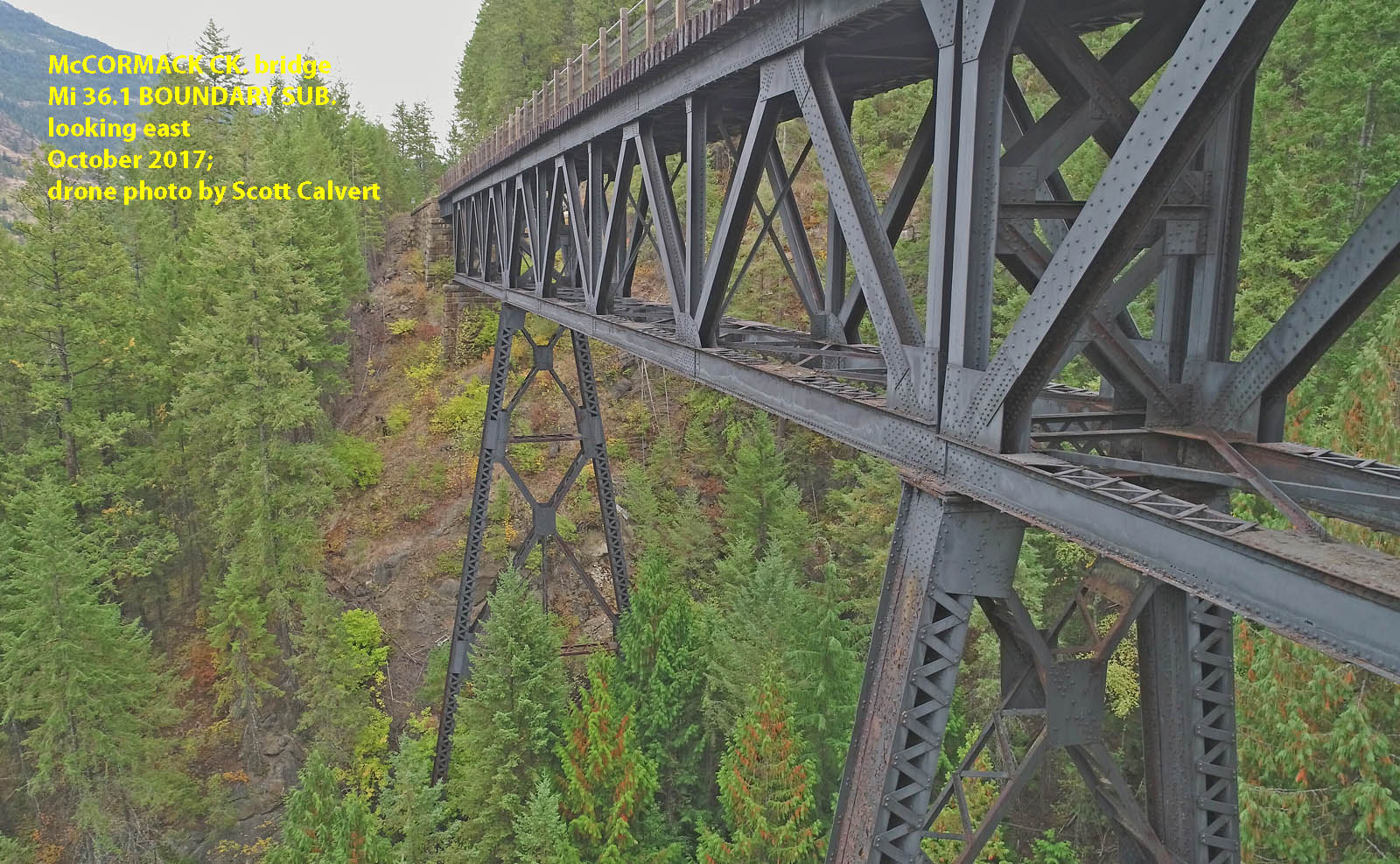
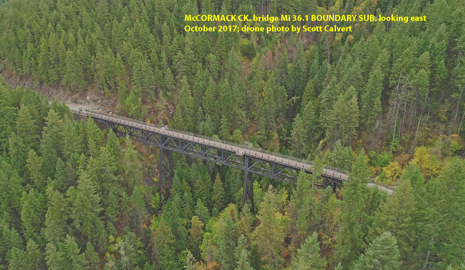
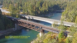
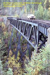
McCormack Ck. Bridge Mi. 36.1 Boundary Sub, looking east. October 2017; drone photo by Scott Calvert.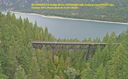
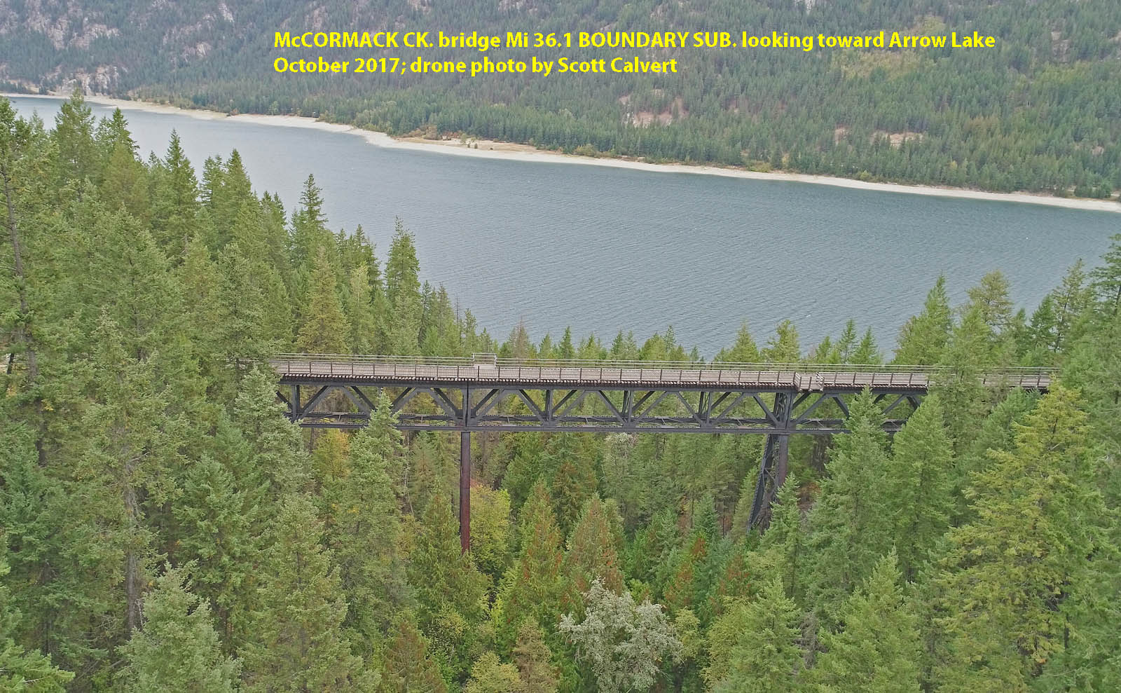
McCormack Ck. Bridge Mi. 36.1 Boundary Sub, looking towards Arrow Lake. October 2017; drone photo by Scott Calvert.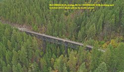
McCormack Ck. Bridge Mi. 36.1 Boundary Sub, looking east. Octobert 2017; drone photo by Scott Calvert.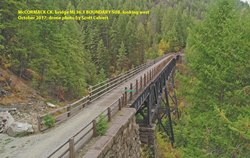
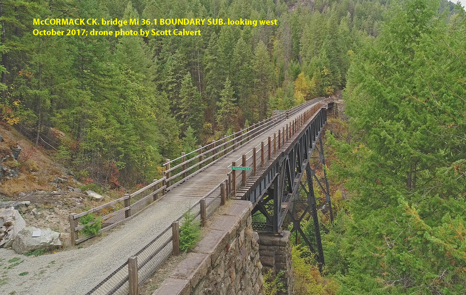
McCormack Ck. Bridge Mi. 36.1 Boundary Sub, looking west. October 2017; drone photo by Scott Calvert.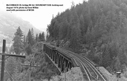
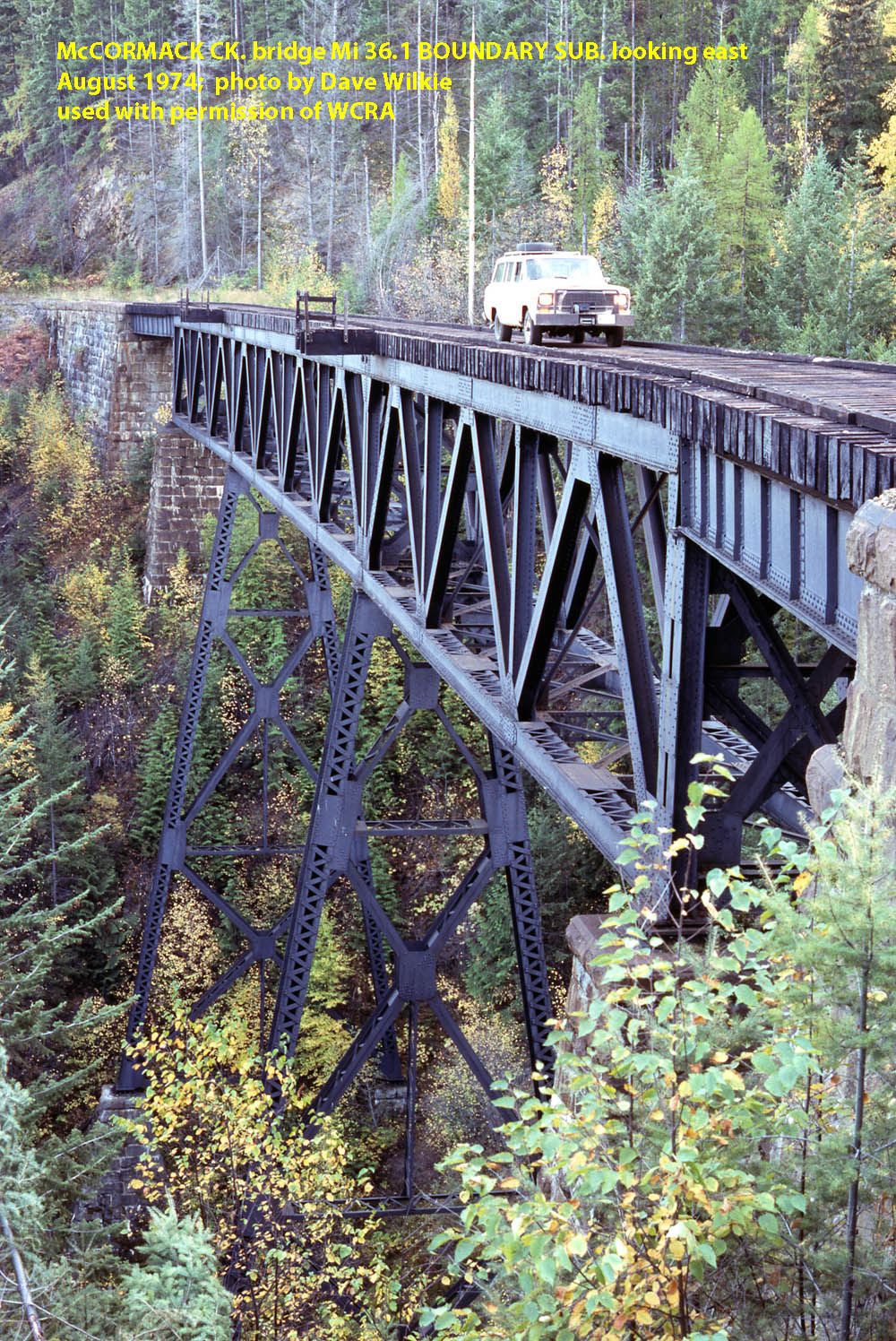
McCormack Ck. Bridge Mi. 36.1 Boundary Sub, looking east. August 1974; photo by Dave Wilkie used with permission of WCRA.
David Wilkie Collection, WCRA Archives.
.
McCormack Ck. Bridge Mi. 36.1 Boundary Sub, looking east. August 1974; photo by Dave Wilkie used with permission of WCRA
David Wilkie Collection, WCRA Archives
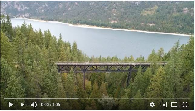
Click the image above to watch a short drone video of the McCormark Creek Bridge.
-
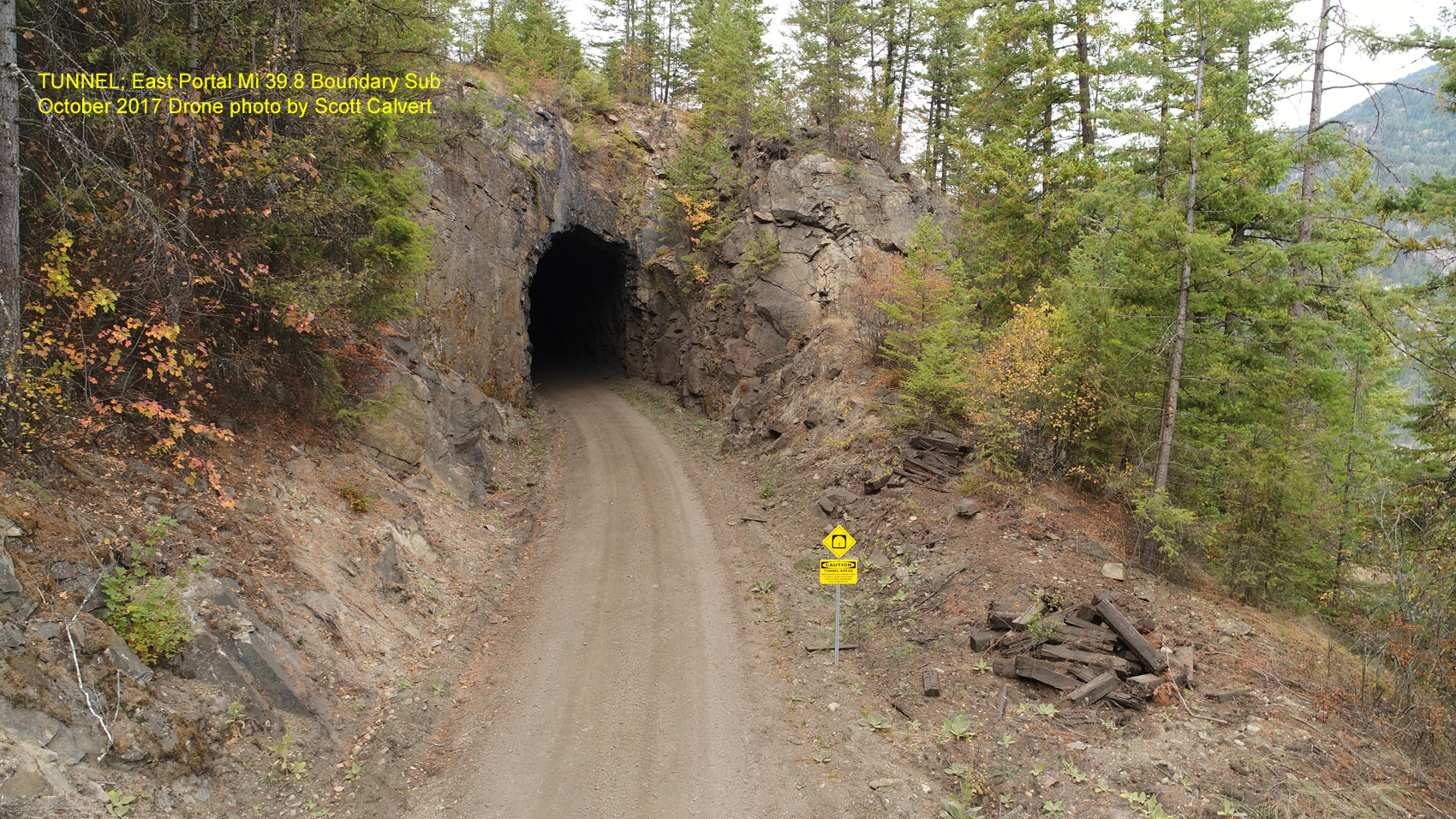
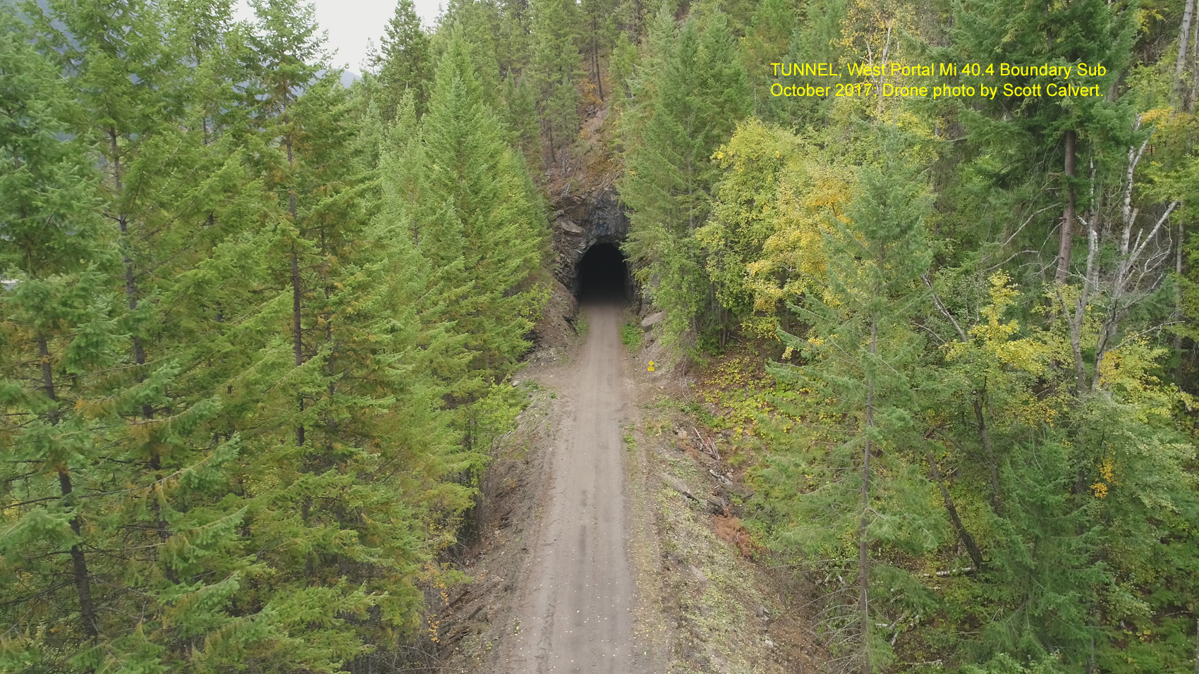
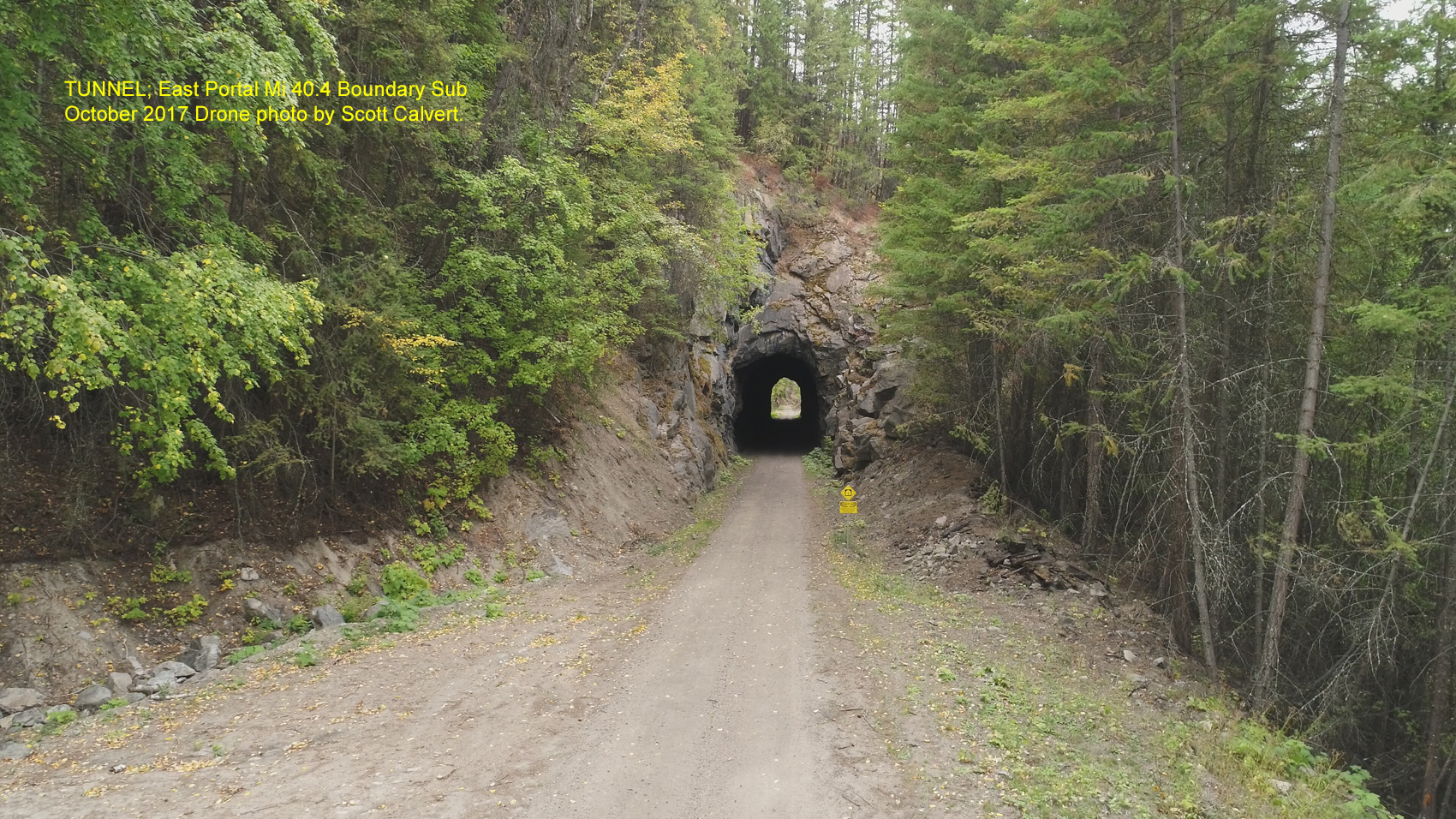
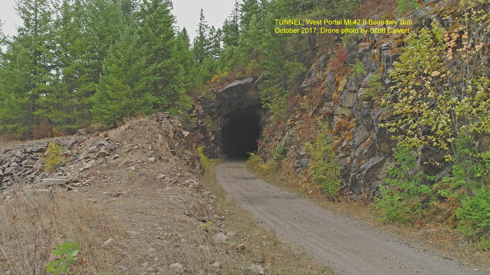
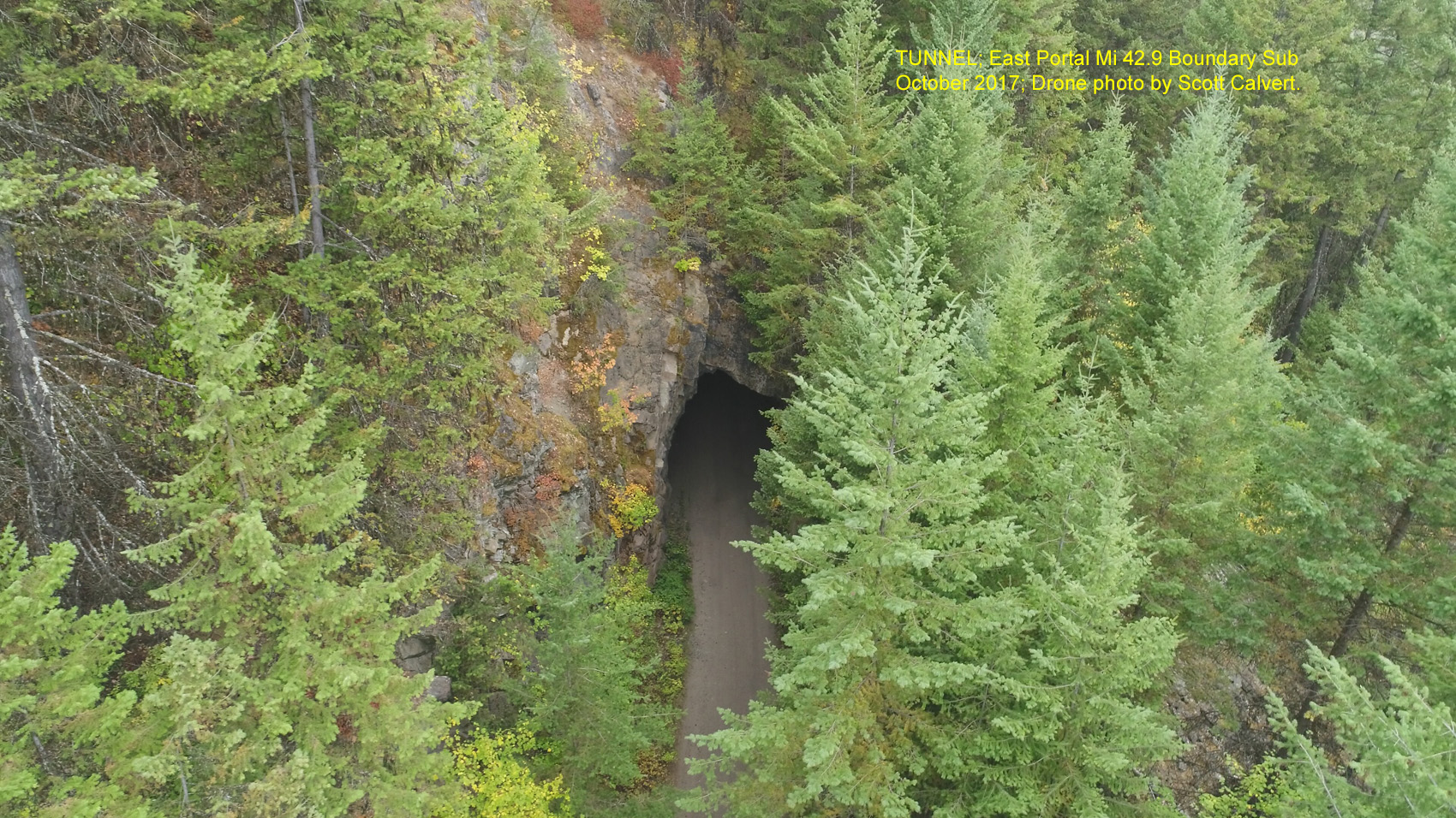
Tunnels (Mi. 39.8, Mi. 40.4, Mi. 42.9)
-
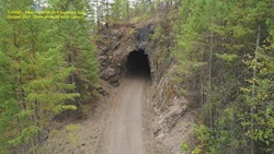
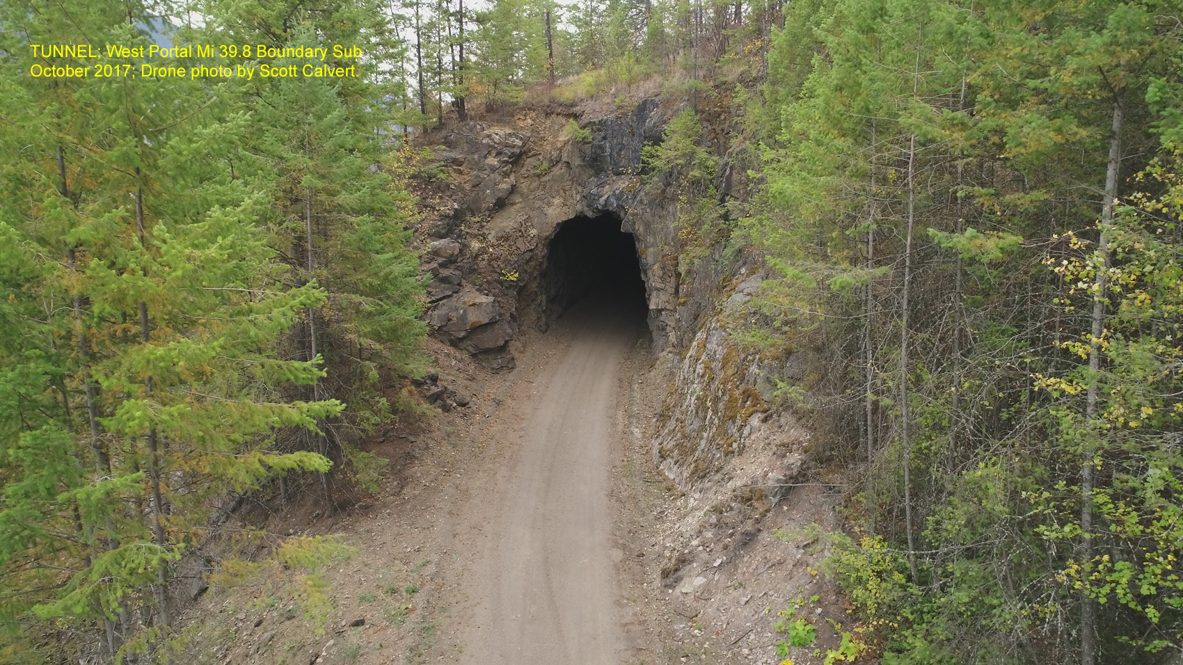
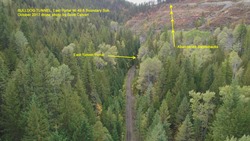
Tunnel, West Portal Mi 39.8 Boundary Sub. October 2017; Drone photo by Scott Calvert.
Tunnel, East Portal Mi 39.8 Boundary Sub. October 2017; Drone photo by Scott Calvert.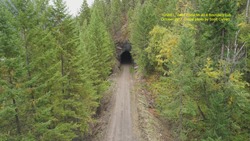
Tunnel, West Portal Mi 40.4 Boundary Sub. October 2017; Drone photo by Scott Calvert.
Tunnel, East Portal Mi 40.4 Boundary Sub. October 2017; Drone photo by Scott Calvert.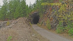
Tunnel, West Portal Mi 42.9 Boundary Sub. October 2017; Drone photo by Scott Calvert.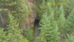
Tunnel, East Portal Mi 42.9 Boundary Sub. October 2017; Drone photo by Scott Calvert.
-
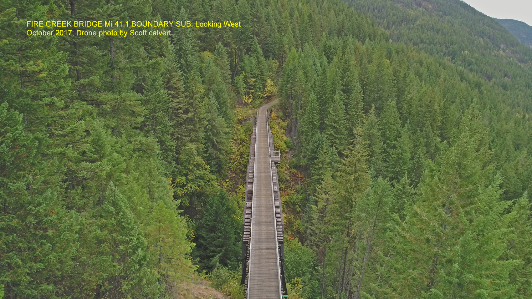
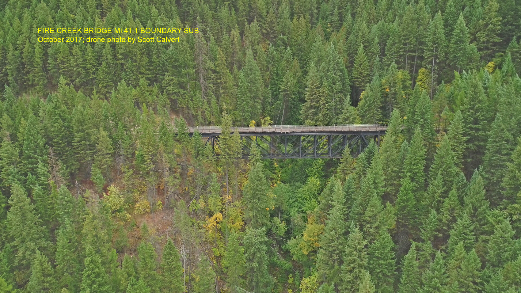
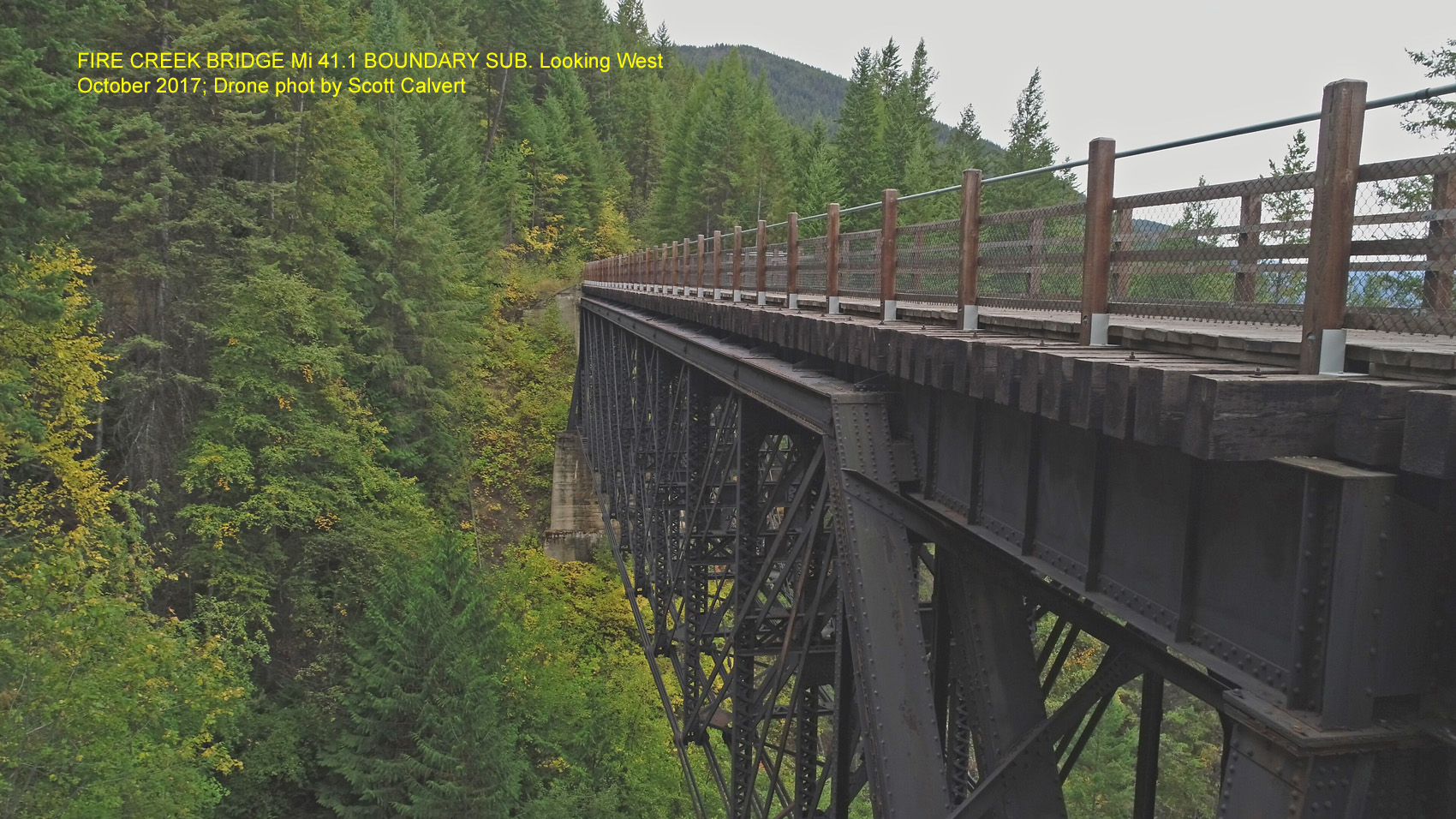
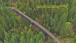
Fire (FaRr) Creek Bridge (Mi. 41.1)
-
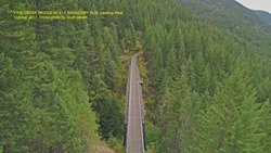
Fire Creek Bridge Mi 41.1 Boundary Sub. Looking West. October 2017; Drone photo by Scott Calvert.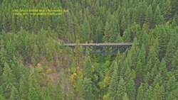
Fire Creek Bridge Mi 41.1 Boundary Sub. October 2017; Drone photo by Scott Calvert.
Fire Creek Bridge Mi 41.1 Boundary Sub. Looking West. October 2017; Drone photo by Scott Calvert.
-
Cub (Bear) Creek Bridge (Mi. 41.7)
-
Cub Creek Bridge Mi 41.7 Boundary Sub Looking east. October 2017; Drone photo by Scott Calvert.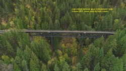
Cub Creek Bridge Mi 41.7 Boundary Sub. October 2017; Drone photo by Scott Calvert.
-
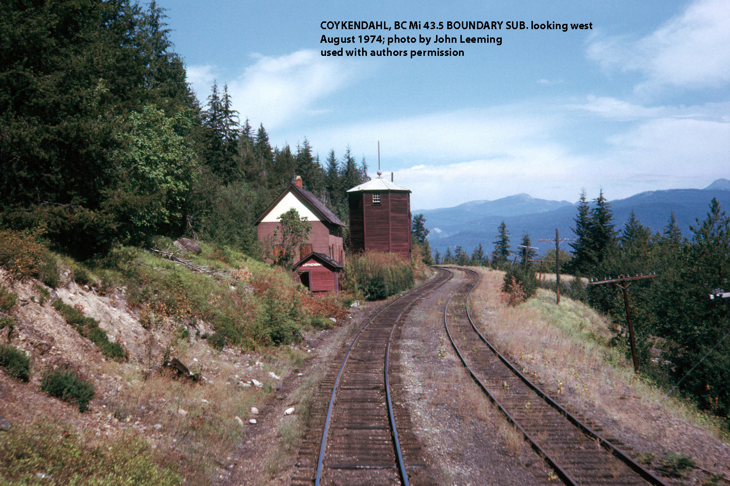
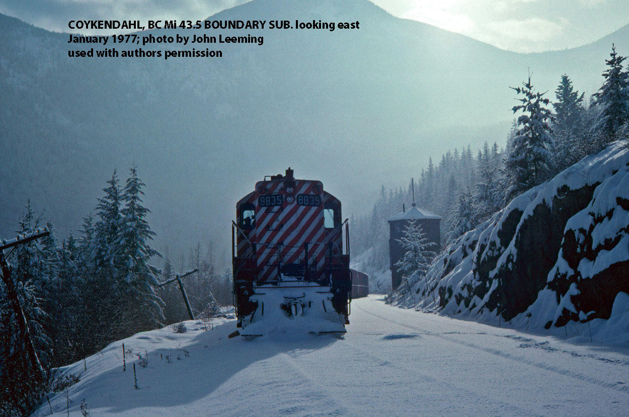
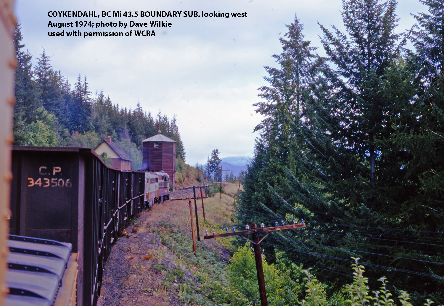
Coykendahl, bc (Mi. 43.5)
-
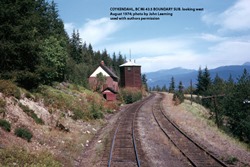
Coykendahl, BC Mi. 43.5 Boundary Sub, looking west. August 1974; photo by John Leeming used with authors permission.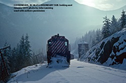
Coykendahl, BC Mi. 43.5 Boundary Sub, looking east, January 1977; photo by John Leeming used with authors permission.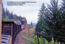
Coykendahl, BC Mi. 43.5 Boundary Sub, looking west. August 1974; photo by Dave Wilkie used with permission of WCRA.
Train #81 passing the section house and abandoned water tank. David Wilkie Collection, WCRA Archives.
-
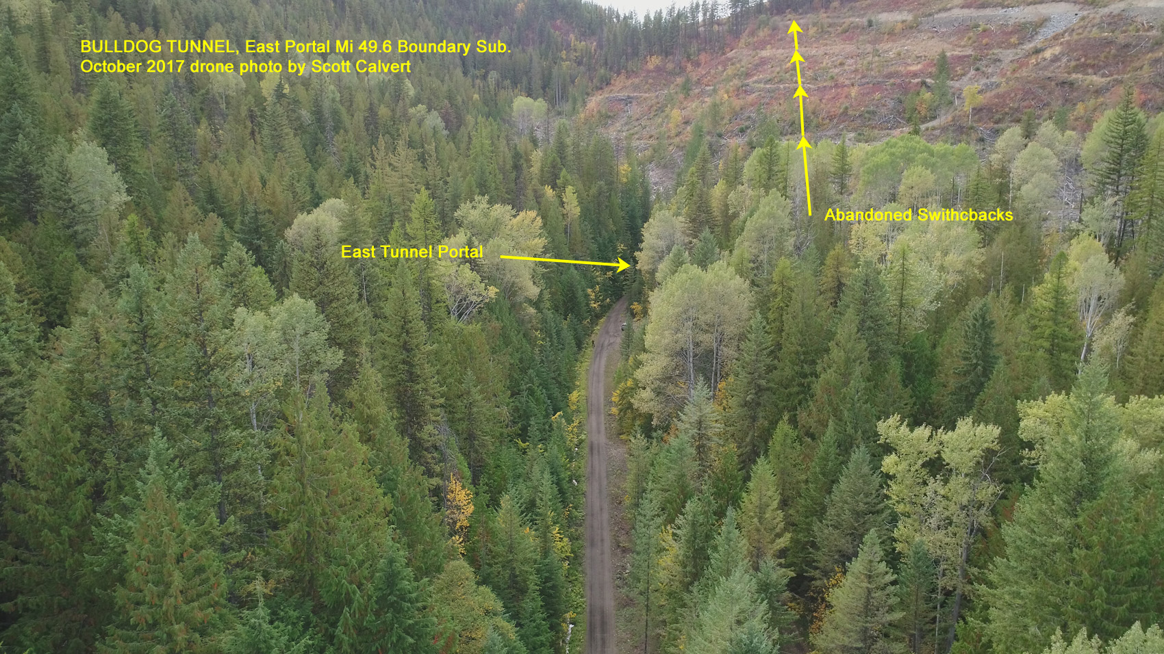
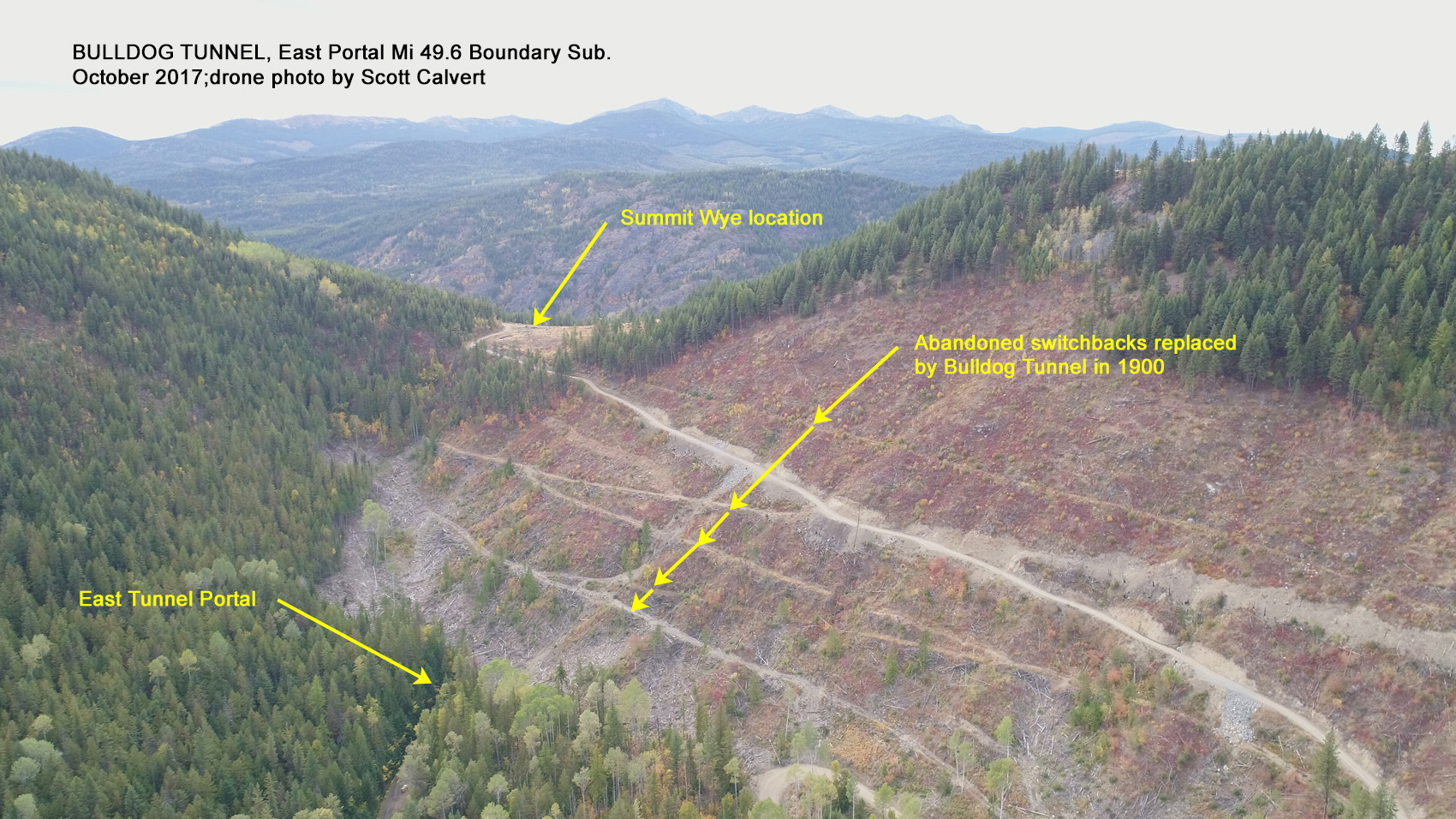
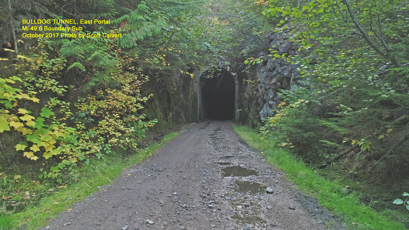
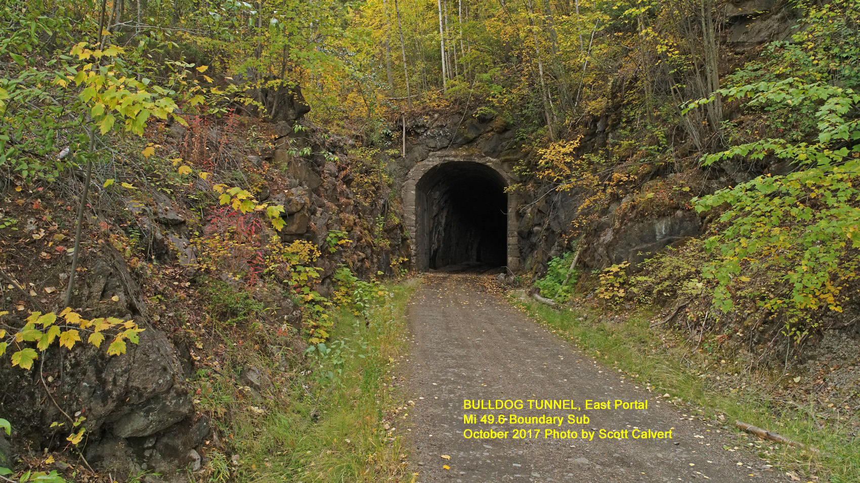
Bulldog Tunnel (Mi. 49.6)
-
Bulldog Tunnel, East Portal Mi 49.6 Boundary Sub. October 2017; Drone photo by Scott Calvert.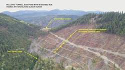
Bulldog Tunnel, East Portal Mi 49.6 Boundary Sub. October 2017; Drone photo by Scott Calvert.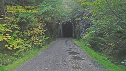
Bulldog Tunnel, East Portal Mi 49.6 Boundary Sub. October 2017; Drone photo by Scott Calvert.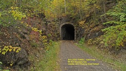
Bulldog Tunnel, East Portal Mi 49.6 Boundary Sub. October 2017; Drone photo by Scott Calvert.
-
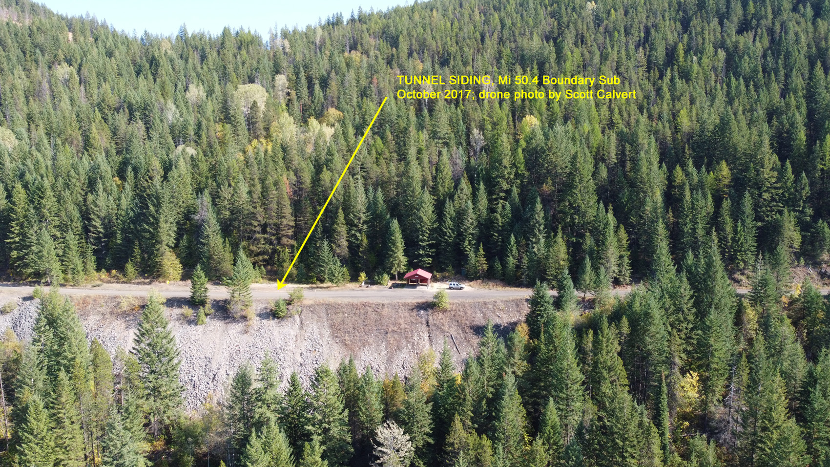
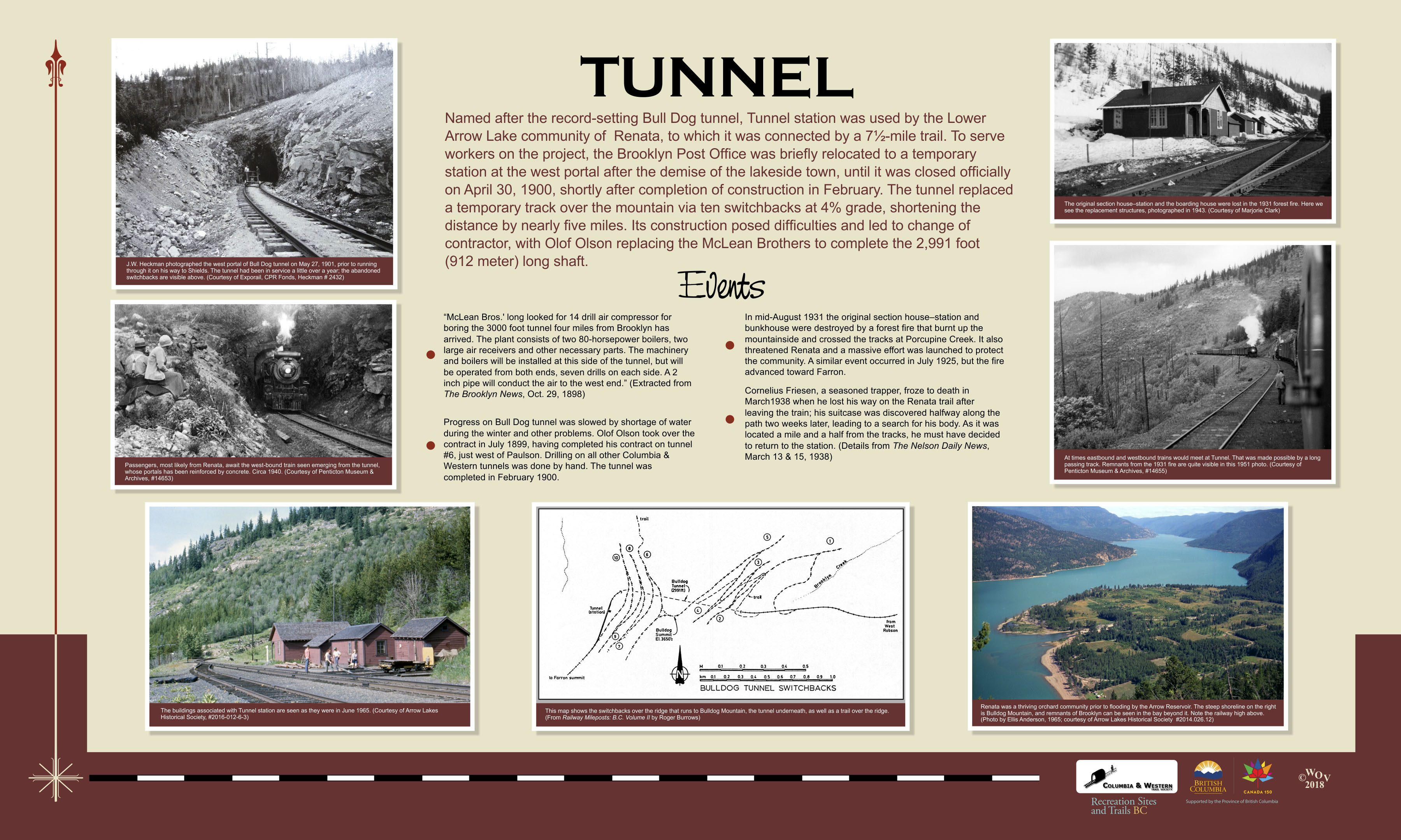
Tunnel Siding (Mi. 50.4)
-

Tunnel Siging, Mi 50.4 Boundary Sub.
October 2017; Drone photo by Scott Calvert.
-
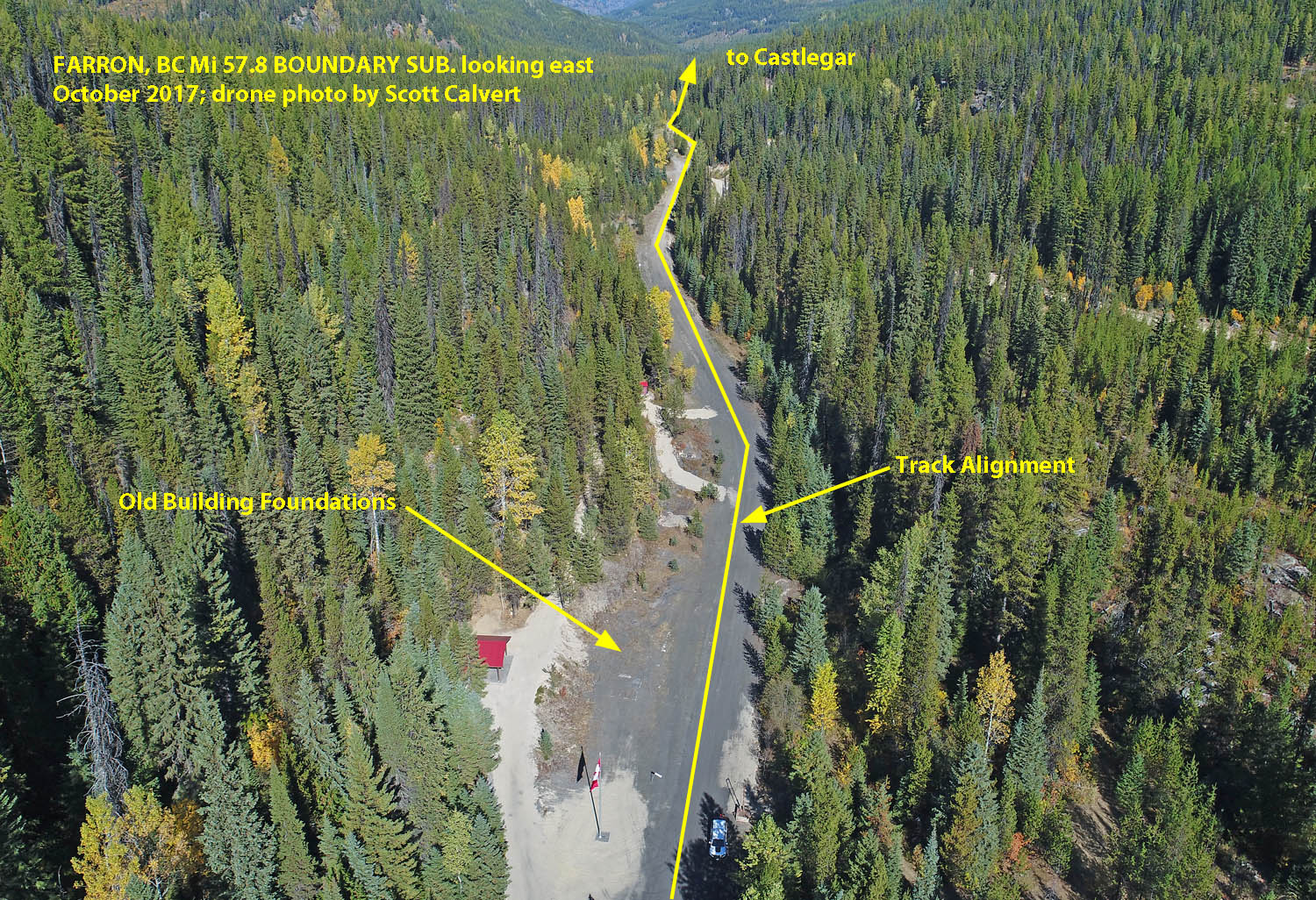
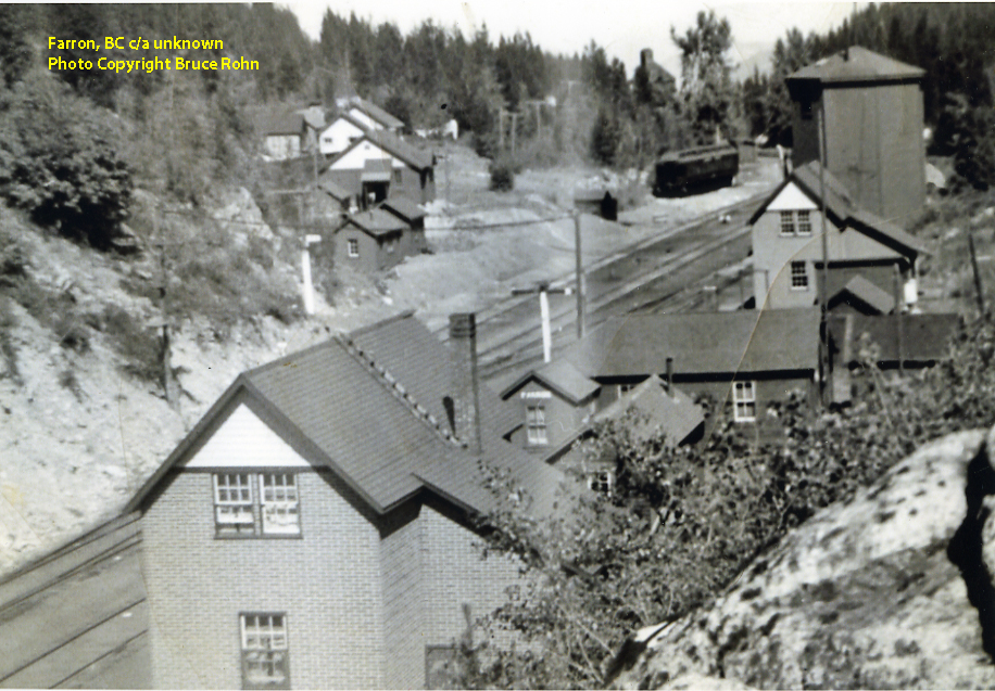
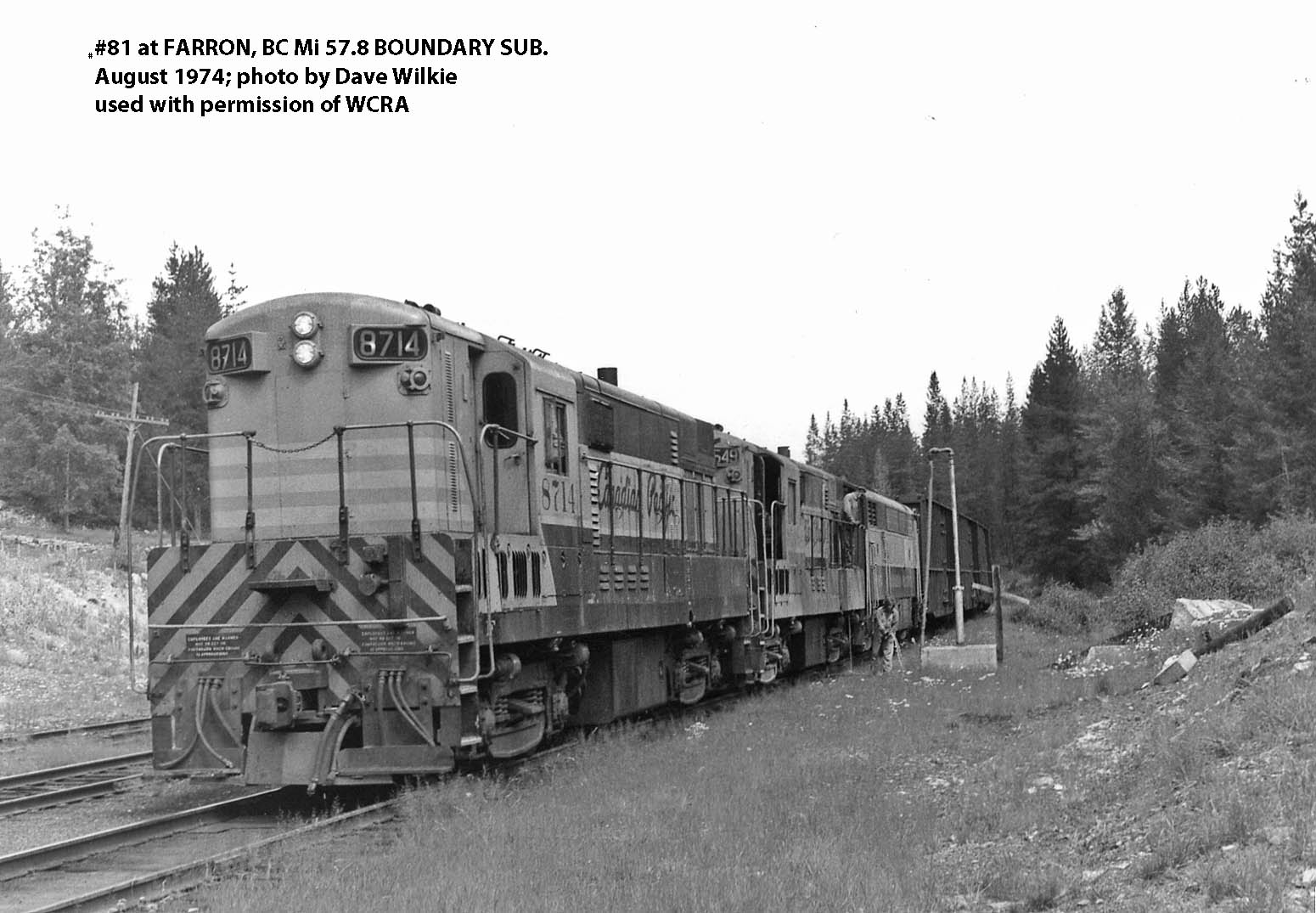
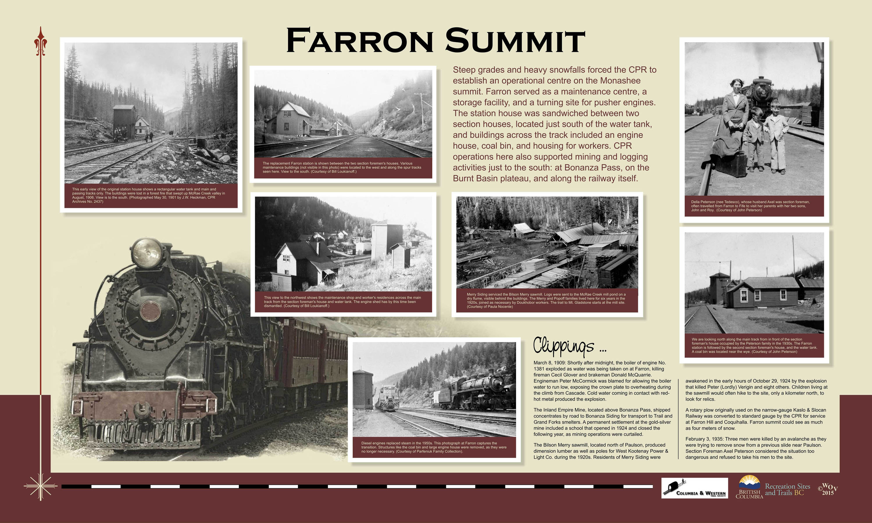
Farron, BC (Mi. 57.8)
-
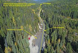
Farron, BC Mi. 57.8 Boundary Sub, looking east. October 2017; drone photo by Scott Calvert..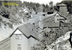
Farron, BC c/a unknown. Photo copyright Bruce Rohn.
#81 at Farron, BC Mi 57.8 Boundary Sub. August 1974; photo by Dave Wilkie used with permission of WCRA.
Train No. 81 at Farron taking on water in unit #8549. David Wilkie Collection, WCRA Archives.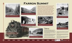
This sign was designed by the Columbia & Western Trail Society and installed in the red roofed kiosk building in the lower left of the drone photograph.
-
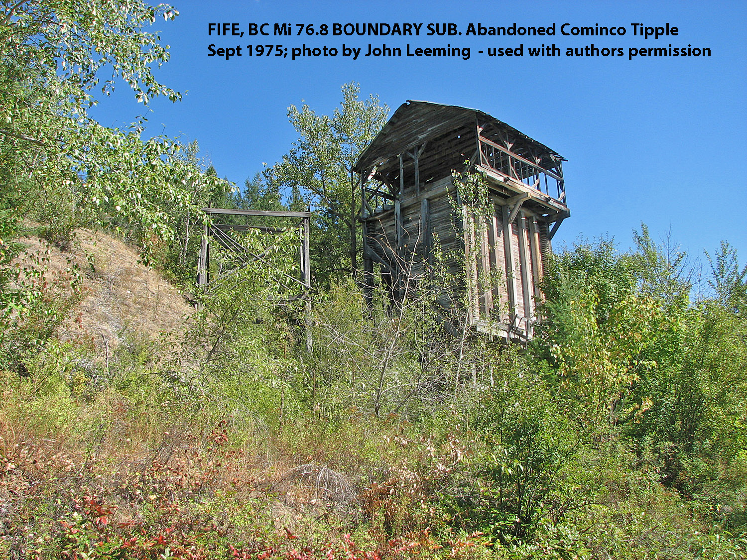
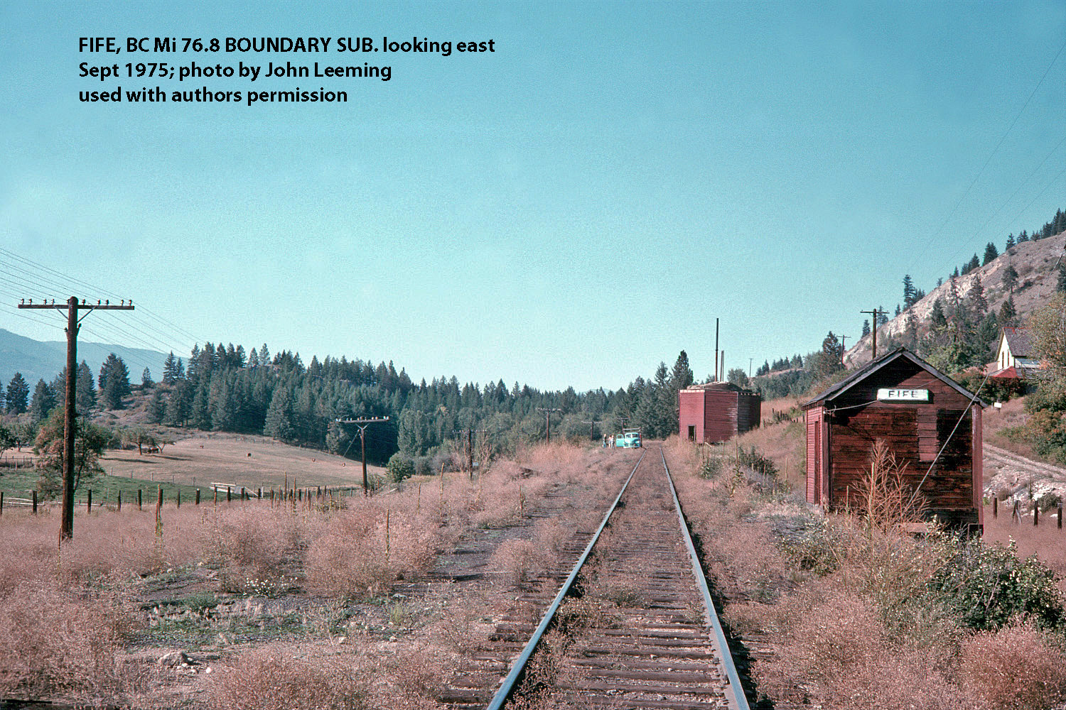
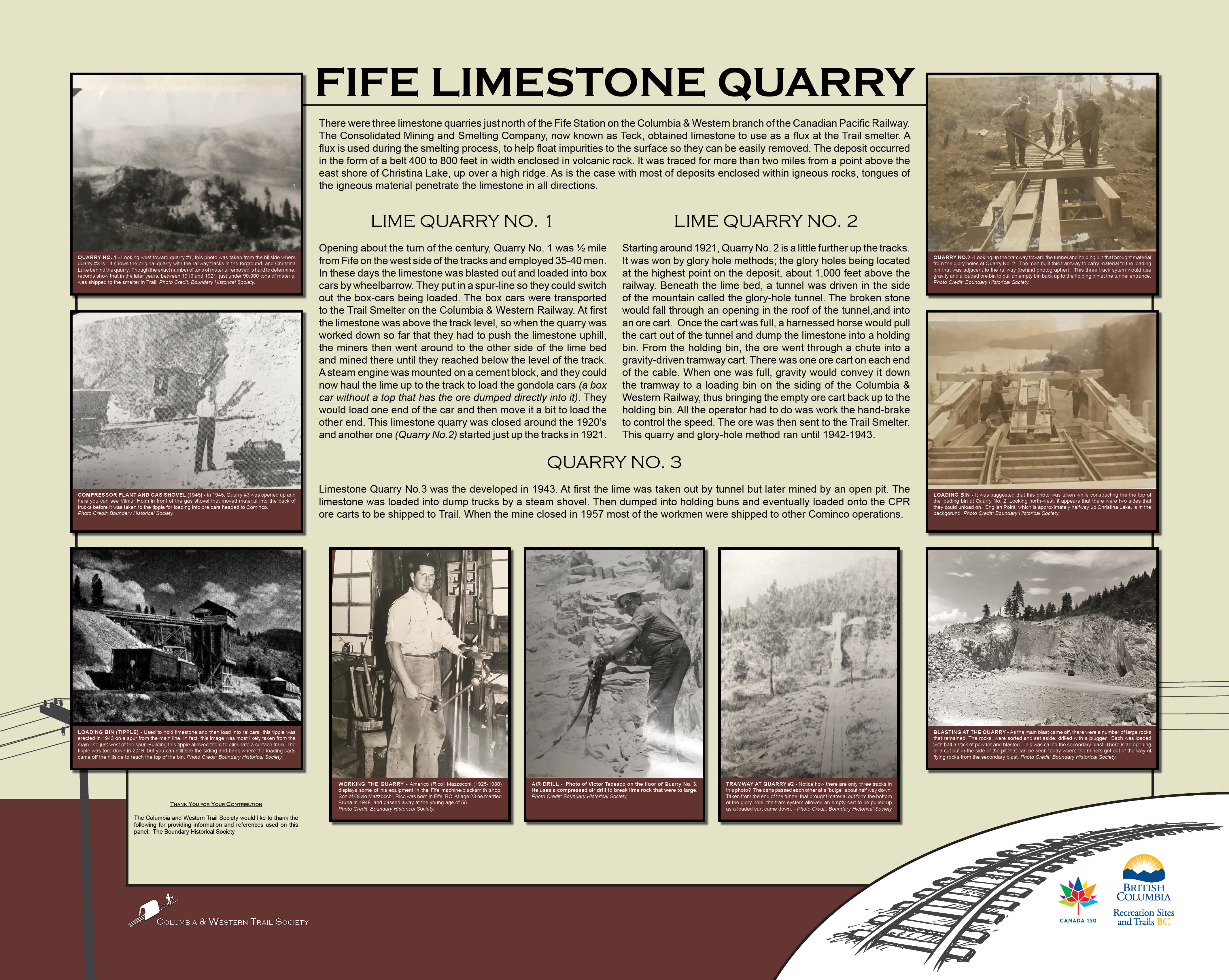
Fife, BC (Mi. 76.8)
-
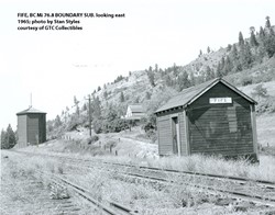
Fife, BC Mi. 76.8 Boundary Sub, looking east. 1965; photo by Stan Styles courtesy of GTC Collectibles.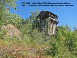
Fife, BC Mi. 76.8 Boundary Sub, abandoned Cominco Tipple. Sept 1975; photo by John Leeming used with authors permission.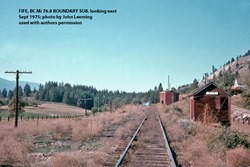
Fife, BC Mi. 76.8 Boundary Sub, looking east. Sept 1975; photo by John Leeming used with authors permission.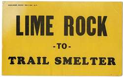
Sample of the typical placard placed on the loaded ore cars destined for the Cominco smelter located at Trail, BC.
-
Kettle River Bridges (Mi. 81.1, Mi. 82.7)
-
Kettle River Bridge, Mi 81.1 CPR Boundary Sub. looking east. October 2017 drone photo by Scott Calvert.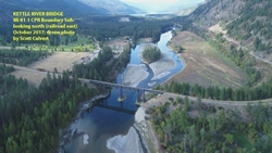
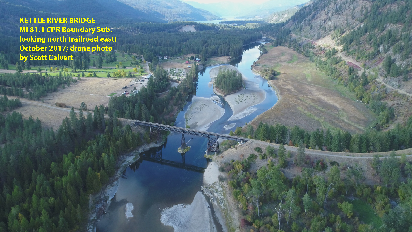
Kettle River Bridge, Mi 81.1 CPR Boundary Sub. looking north (railroad east). October 2017 drone photo by Scott Calvert.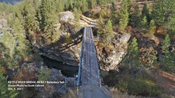
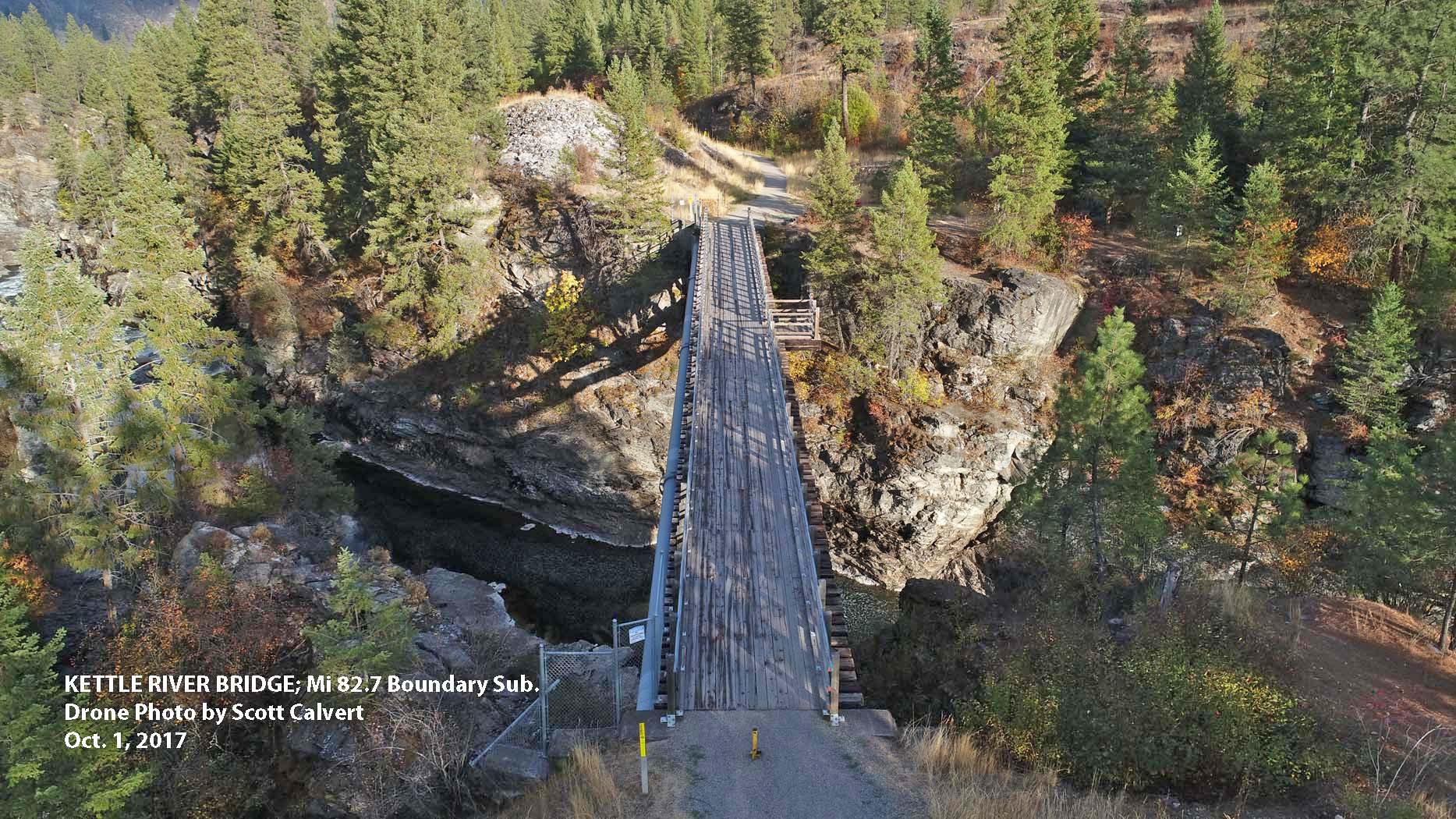
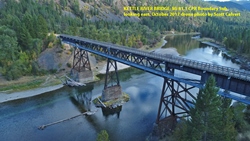
Kettle River Bridge, Mi 82.7 Boundary Sub. October 2017 drone photo by Scott Calvert.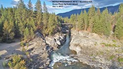
Kettle River Bridge, Mi 82.7 Boundary Sub. October 2017 drone photo by Scott Calvert.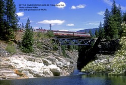
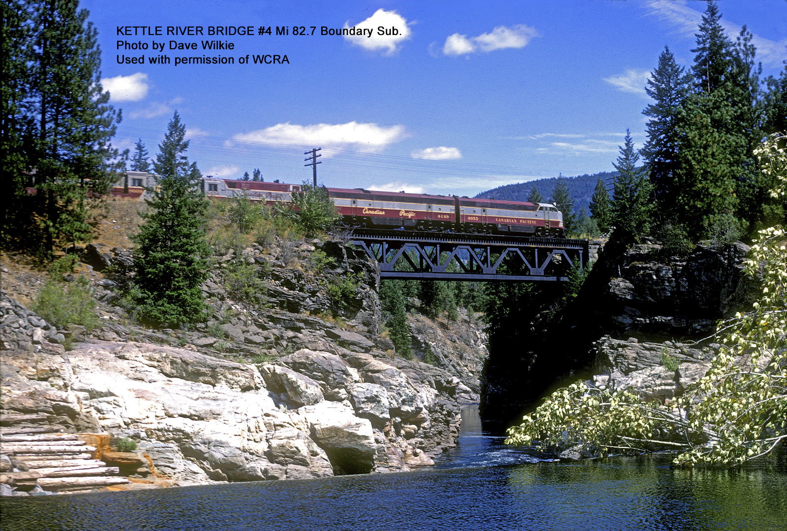
Kettle River Bridge, Mi 82.7 Boundary Sub. Photo by Dave Wilkie. Used with Permission.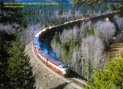
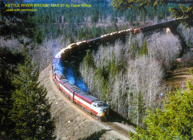
Kettle River Bridge. Mar 1967. Photo by Dave Wilkie. Used with Permission.
-
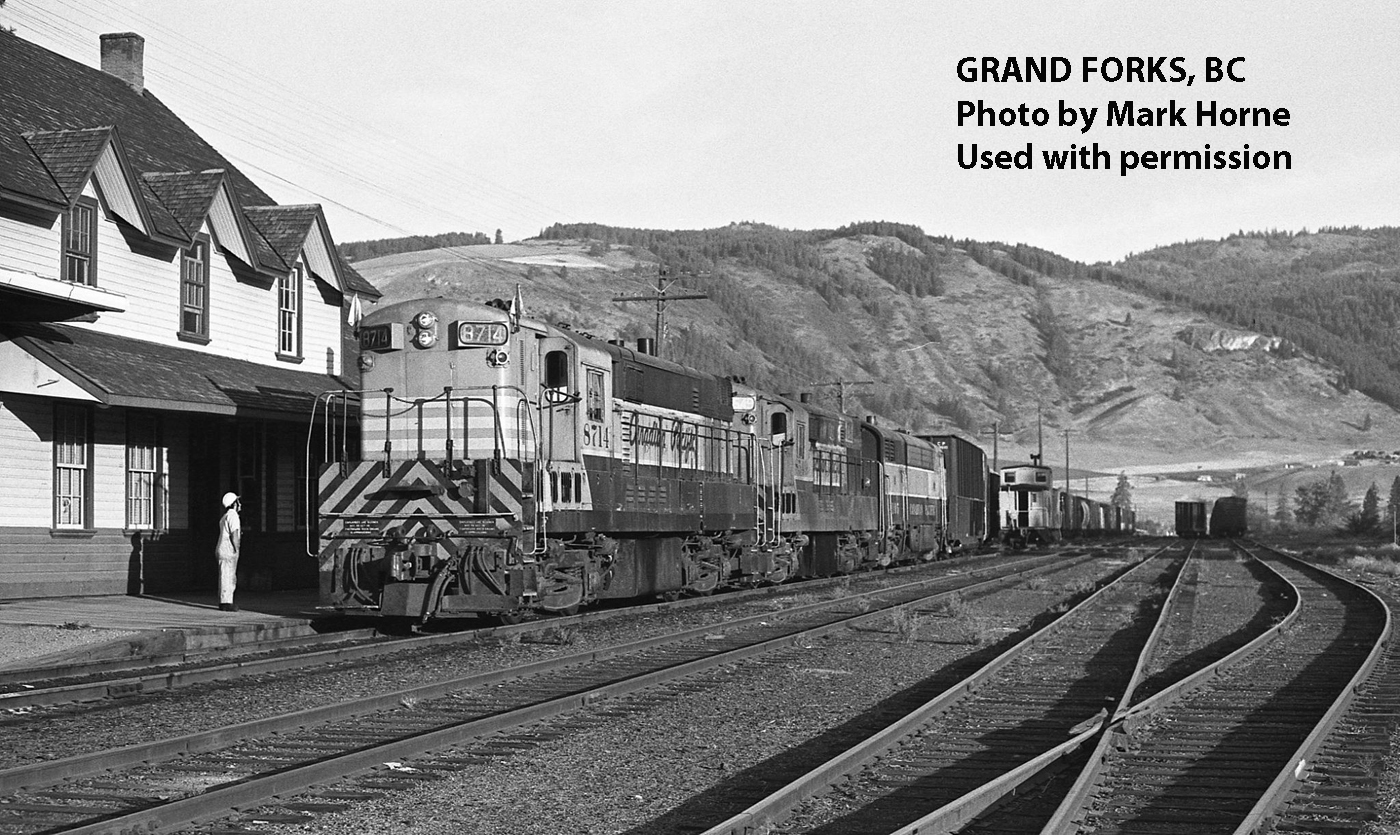
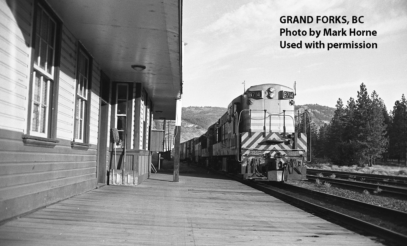
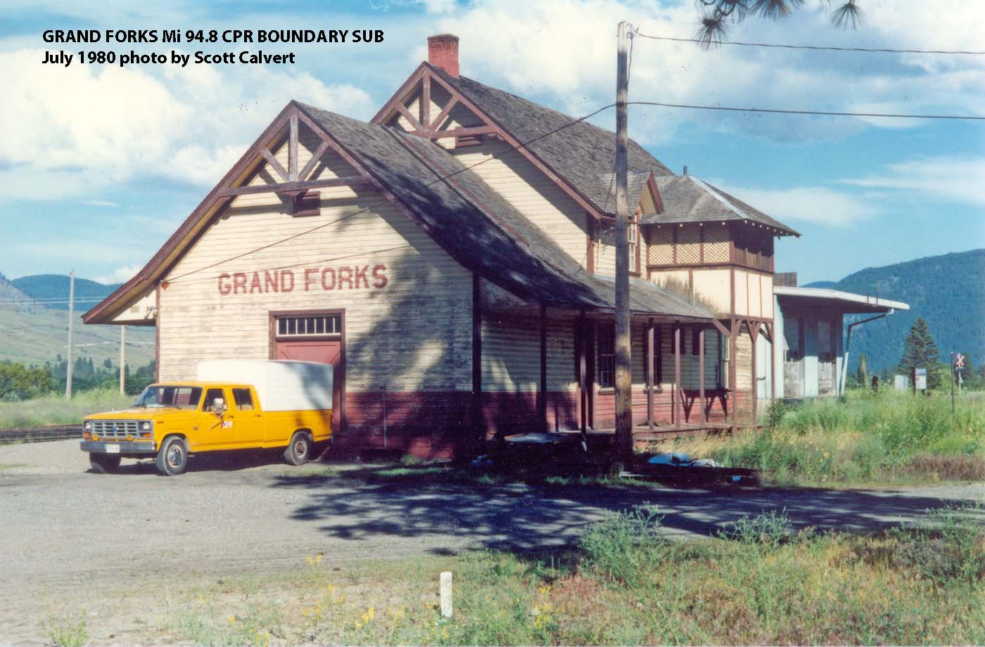
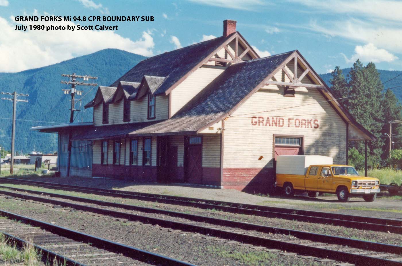
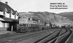
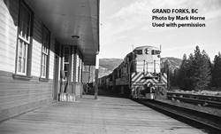
Grand Forks, BC (Mi. 94.8)
-
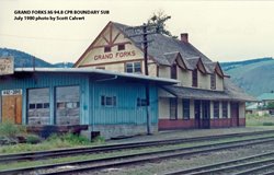
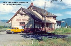
Grand Forks Mi 94.8 CPR Boundary Sub (July 1980 by Scott Calvert)
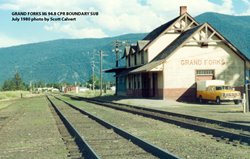
Grand Forks Mi 94.8 CPR Boundary Sub (July 1980 by Scott Calvert)
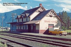
Grand Forks Mi 94.8 CPR Boundary Sub (July 1980 by Scott Calvert)
Grand Forks Mi 94.8 CPR Boundary Sub (July 1980 by Scott Calvert)

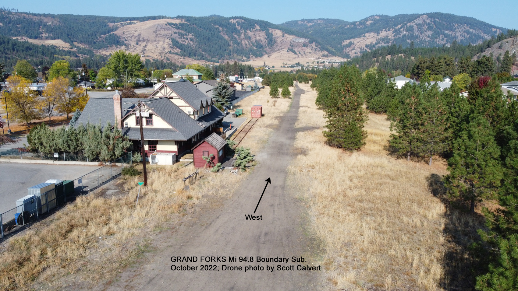
Grand Forks Mi 94.8 Boundary Sub. October 2022; Drone photo by Scott Calvert.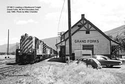
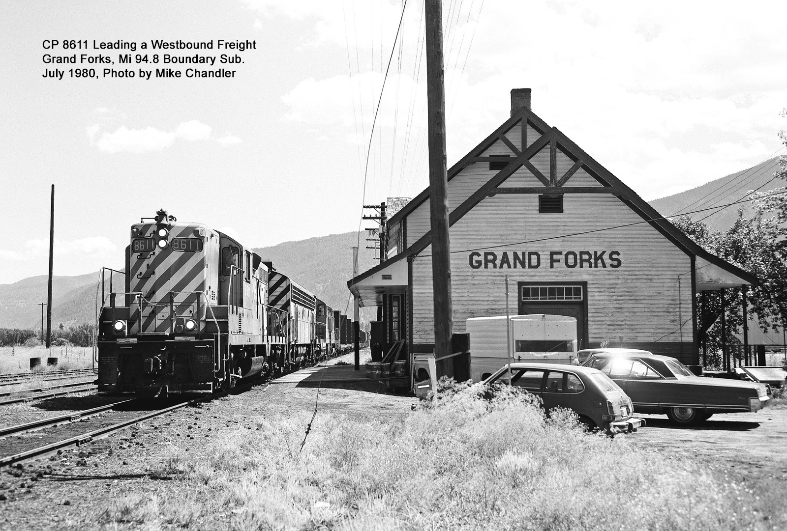
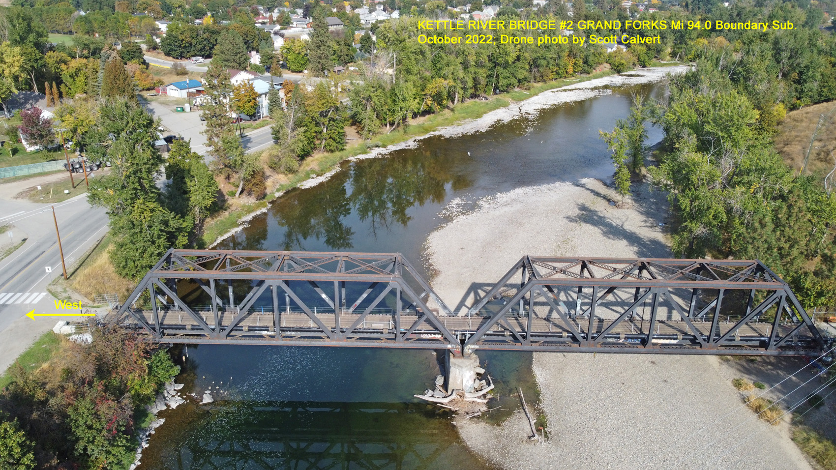
CP 8611 Leading a Westbound Freight Grand Forks, Mi 94.8 Boundary Sub. July 1980, photo by Mike Chandler.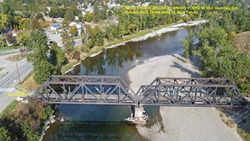 Kettle River Bridge #2 Grand Forks Mi 94.0 Boundary Sub. October 2022; Drone photo by Scott Calvert.
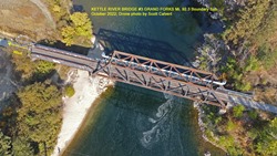
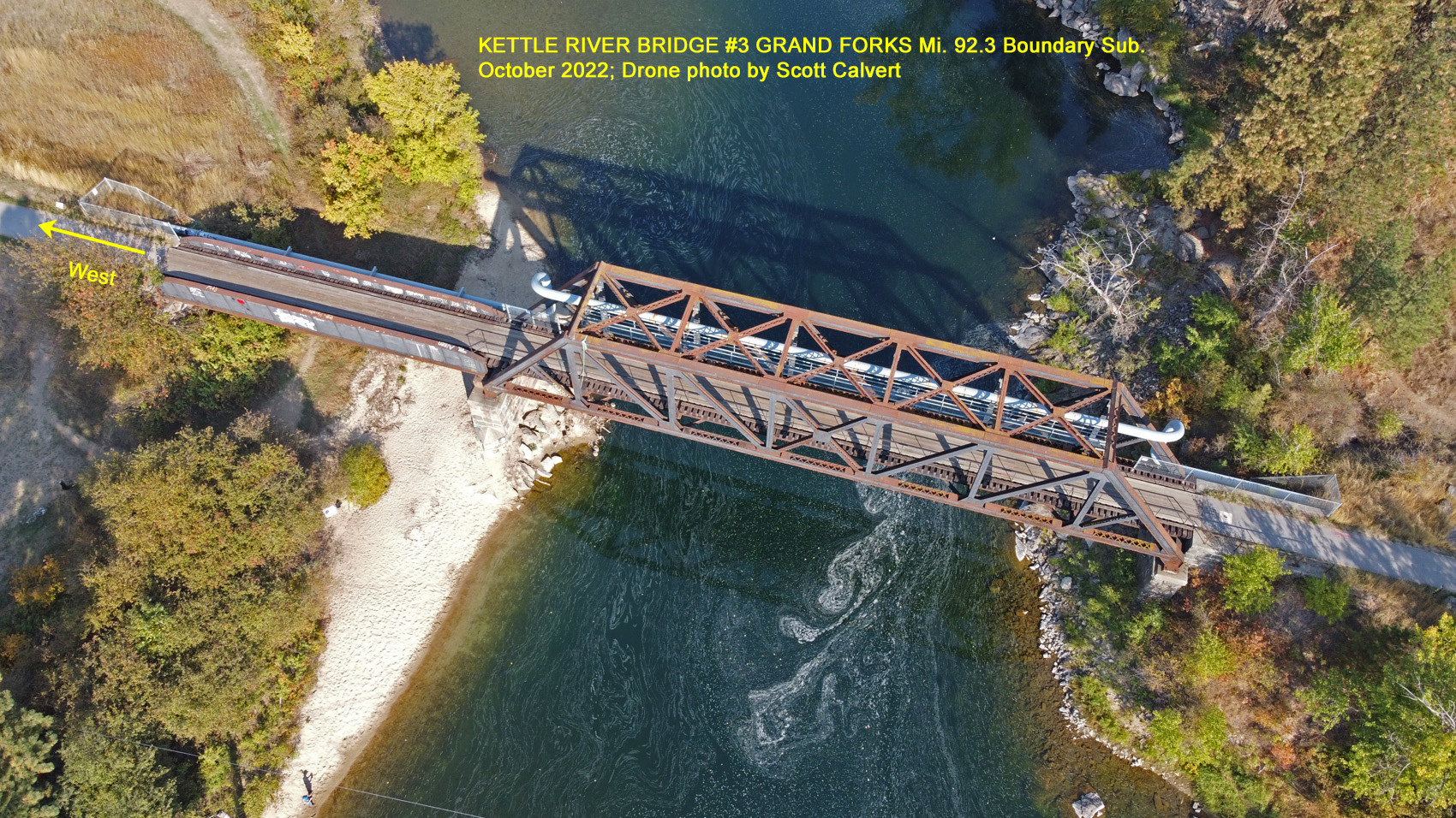
Kettle River Bridge #3 Grand Forks, Mi. 92.3 Boundary Sub. Octobert 2022; Drone photo by Scott Calvert.
-
Tunnels (Mi. 102.0, Mi. 104.9)
-
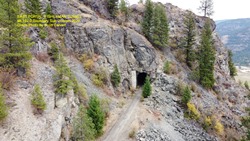
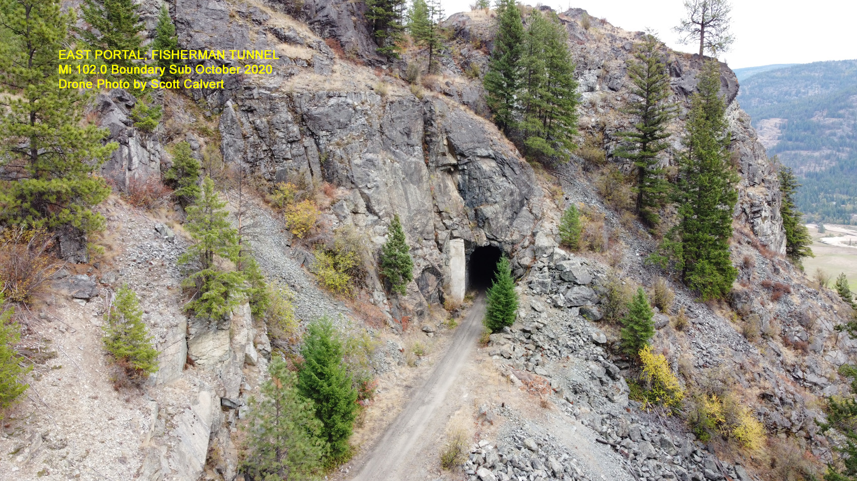
East Portal; Fisherman Tunnel Mi 102.0 Boundary Sub. October 2020. Drone photo by Scott Calvert.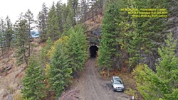
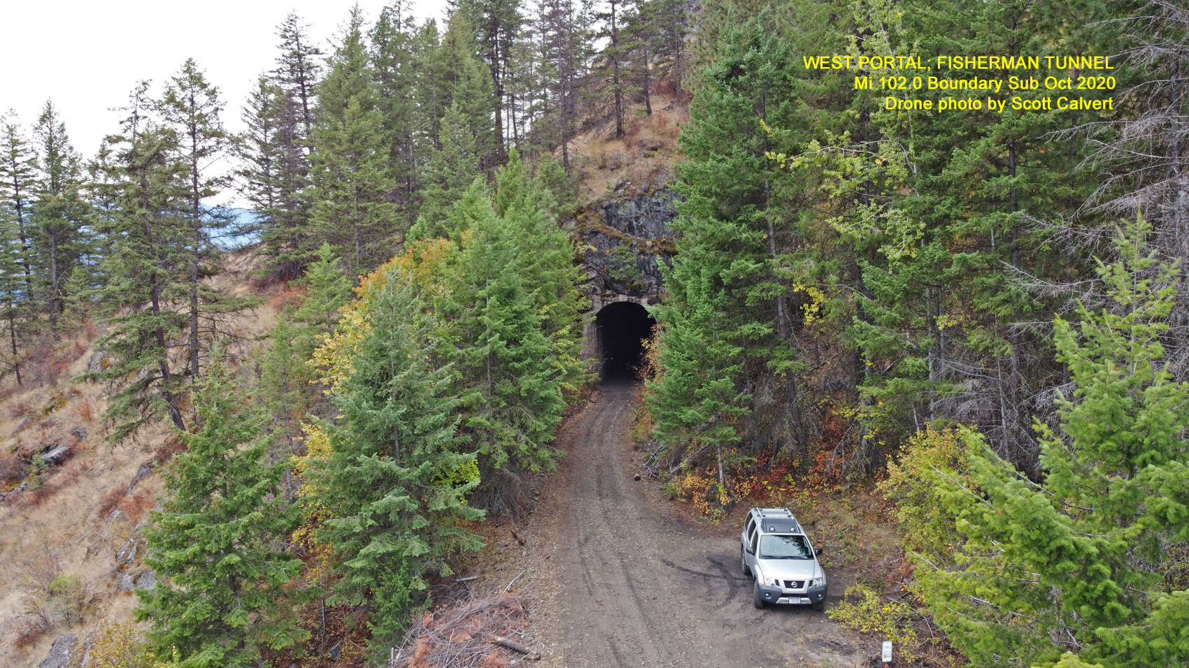
West Portal; Fisherman Tunnel Mi 102.0 Boundary Sub. October 2020. Drone photo by Scott Calvert.
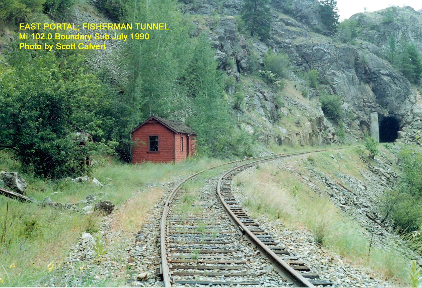
East Portal; Fisherman Tunnel Mi 102.0 Boundary Sub. July 1990. Photo by Scott Calvert.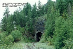
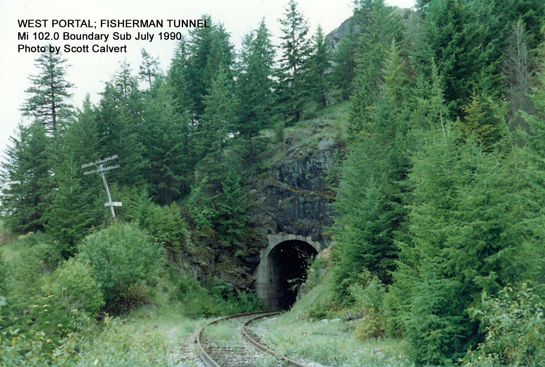
West Portal; Fisherman Tunnel Mi 102.0 Boundary Sub. July 1990. Photo by Scott Calvert.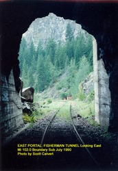
East Portal; Fisherman Tunnel Looking East Mi 102.0 Boundary Sub. July 1990. Photo by Scott Calvert. -
-
Eholt, BC (Mi. 108.8)
-
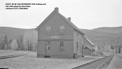
Eholt, BC Mi. 108.8 Boundary Sub, looking west. July 1960; photo by Stan Styles courtesy of GTC Collectibles.
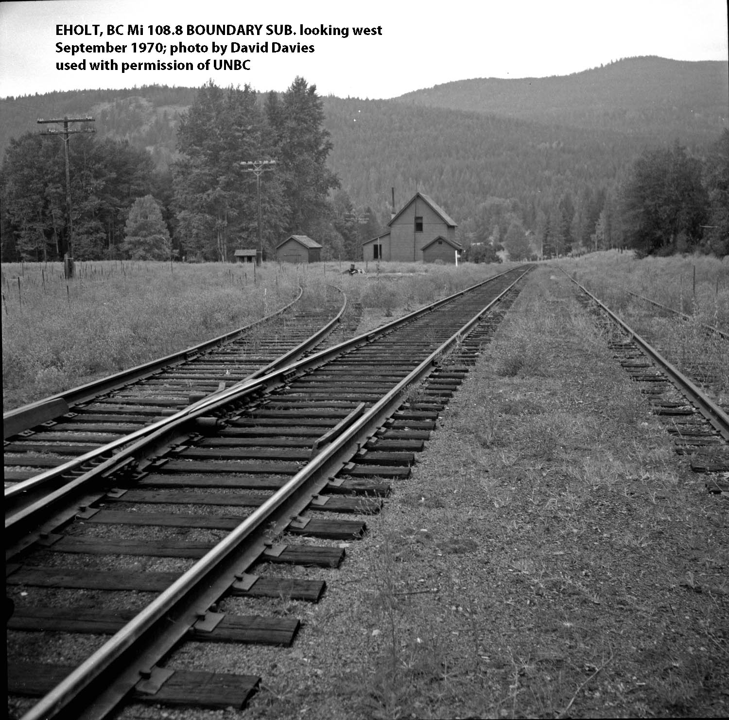
Eholt, BC Mi. 108.8 Boundary Sub, looking west. September 1970; photo by David Davies used with permission of UNBC.
David Davies Railway Collection; Northern BC Archives, UNBC Accession No. 2013.6.36.1.028.11
Photograph depicts the CPR line at Eholt, located at mile 108.7 from Nelson on the Boundary Subdivision. It was a formerly bustling junction with the left-hand spur leading to Phoenix. At the time of this photo, it only had 3 way freight trains a week from Nelson to Midway. https://search.nbca.unbc.ca/index.php/eholt-junction-on-cpr-line
.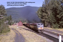
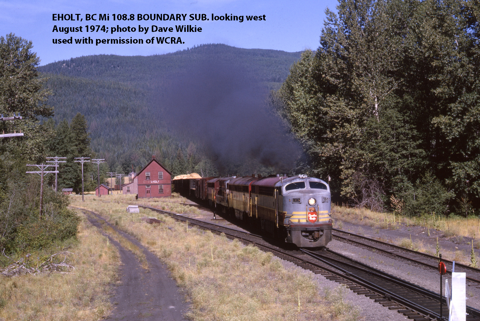
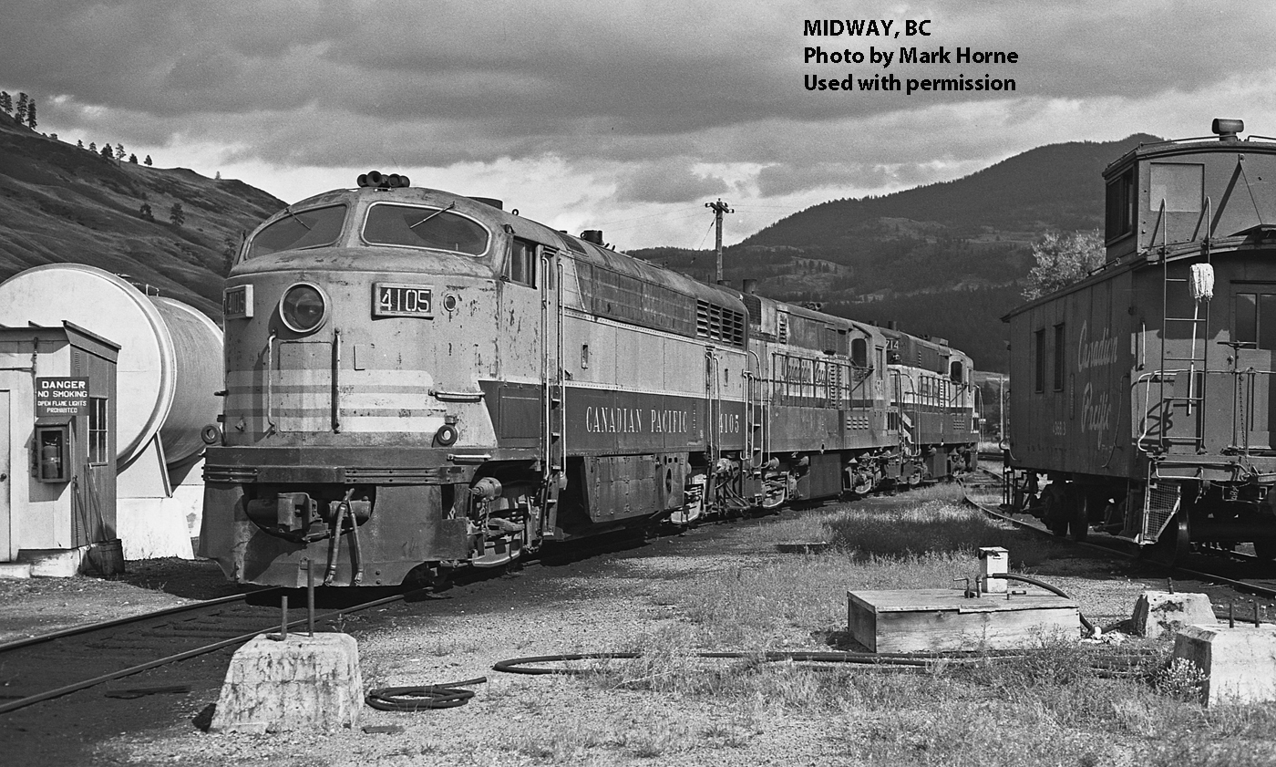
Eholt, BC Mi. 108.8 Boundary Sub, looking west. August 1974; photo by Dave Wilkie used with permission of WCRA.
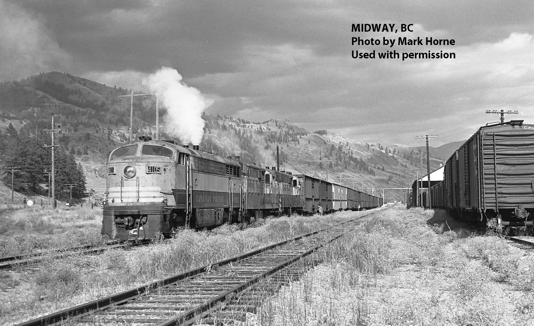
Extra 4105 eastbound passing what is left of the original Columbia & Western station with the abandoned line to Phoenix running off on the left side of the photo. David Wilkie Collection, WCRA Archive.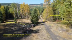 Eholt Siding, Mi 108.8 Boundary Sub. looking West. October 2020. Drone photo by Scott Calvert.
-
Greenwood (Mi. 118.3)
-
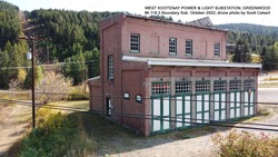
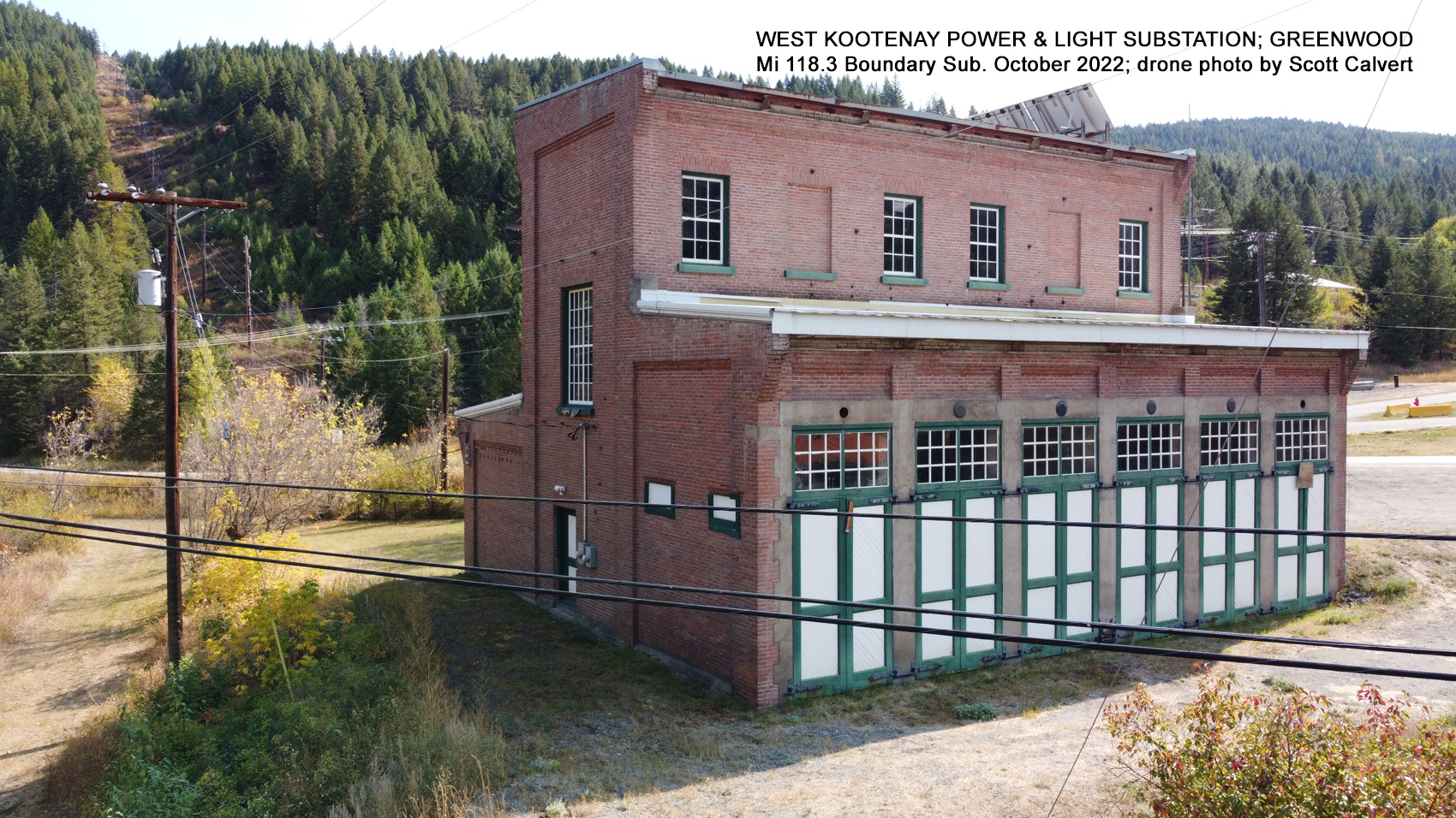
West Kootenay Power & Light Substation, Greenwood M1 118.3 Boundary Sub. October 2022. Drone photo by Scott Calvert.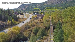
Boundary Creek Bridge #2 Mi 118.3 Boundary Sub. October 2022. Drone photo by Scott Calvert.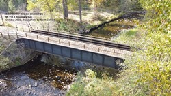
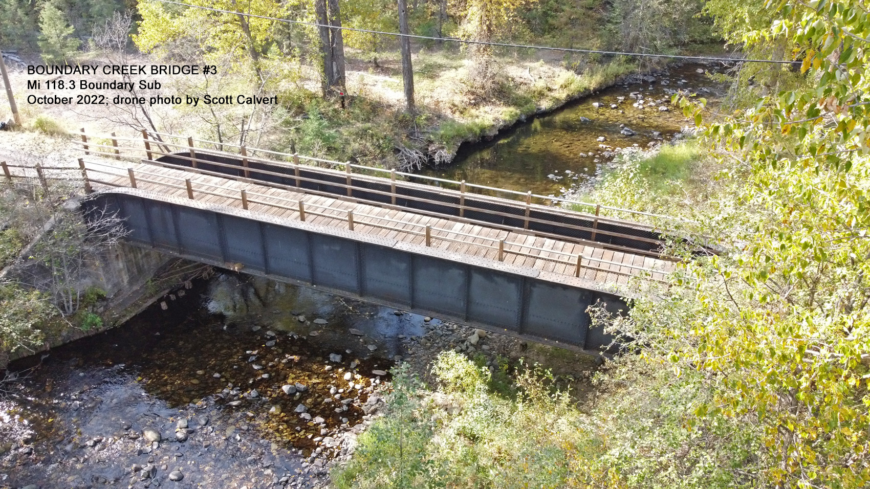
Boundary Creek Bridge #3 Mi 118.3 Boundary Sub. October 2022. Drone photo by Scott Calvert.
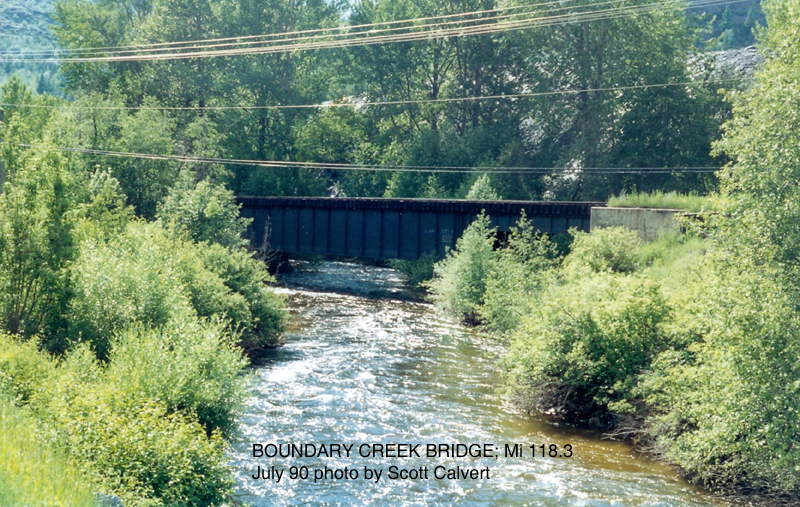
Boundary Creek Bridge Mi 118.3 Boundary Sub. July 1990. Photo by Scott Calvert.
-
-
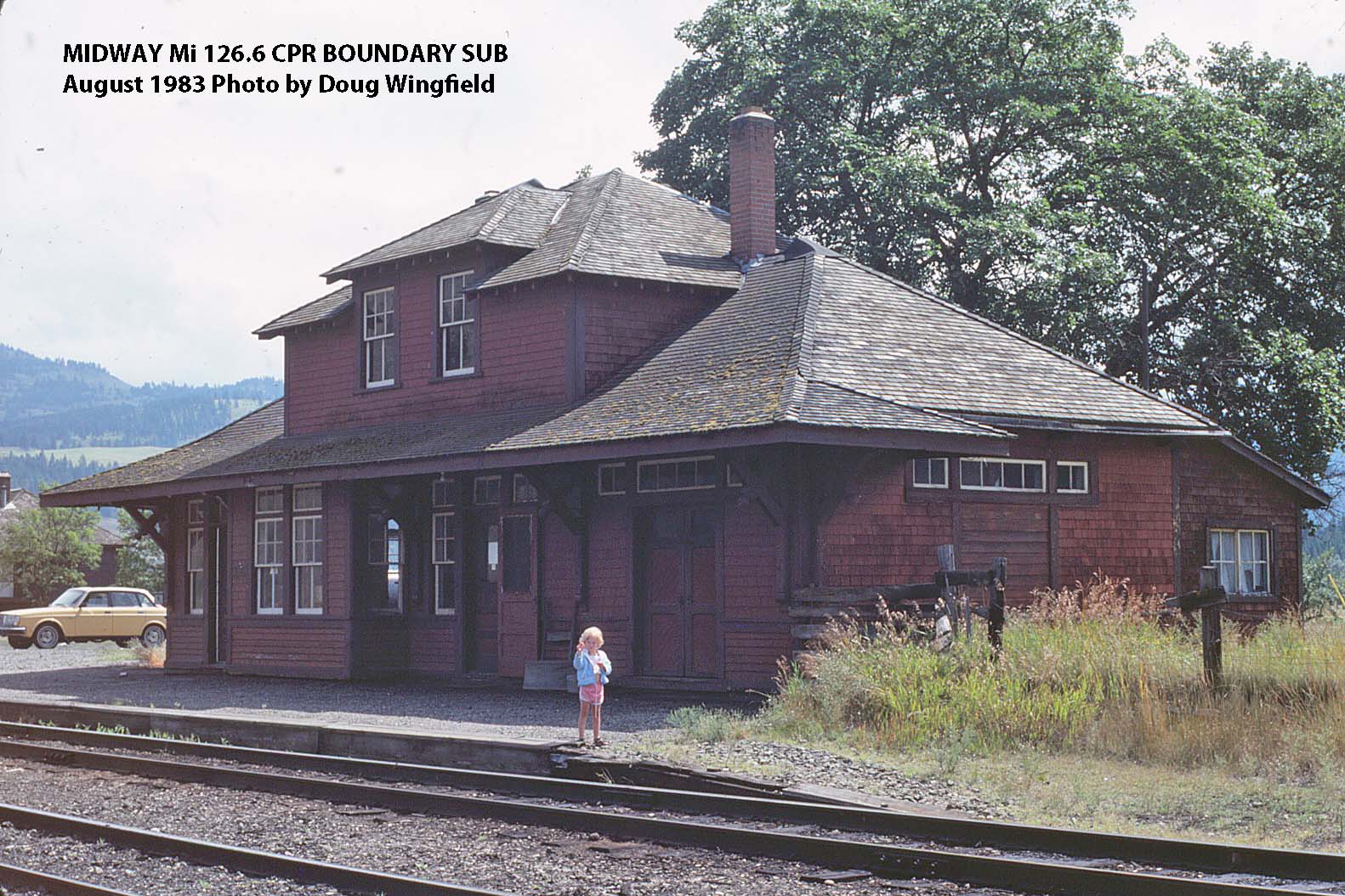
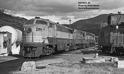
Midway, BC (Mi. 126.6)
-

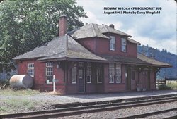
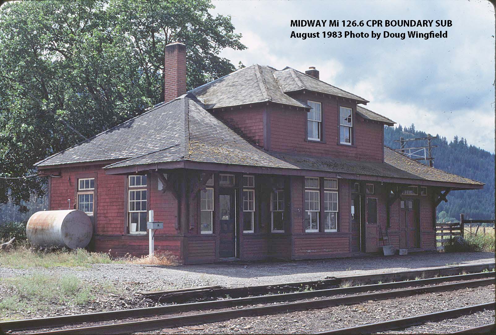
Midway Mi 126.6 CPR Boundary Sub (Aug 1983 by Doug Wingfield)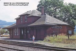
Midway Mi 126.6 CPR Boundary Sub (Aug 1983 by Doug Wingfield)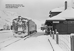
Midway Mi 126.6 Boundary Sub. Train #46 Westbound Dec. 27, 1963. Photo by Mike Chandler.
-