-
boundary subdivision prototype
-
The Boundary Subdivision, located in south eastern British Columbia, had its beginnings in 1890 when the CPR chartered the Columbia and Kootenay Railway & Navigation Co. to run from Nelson on the Kootenay Lake overland west to the Columbia River.
-
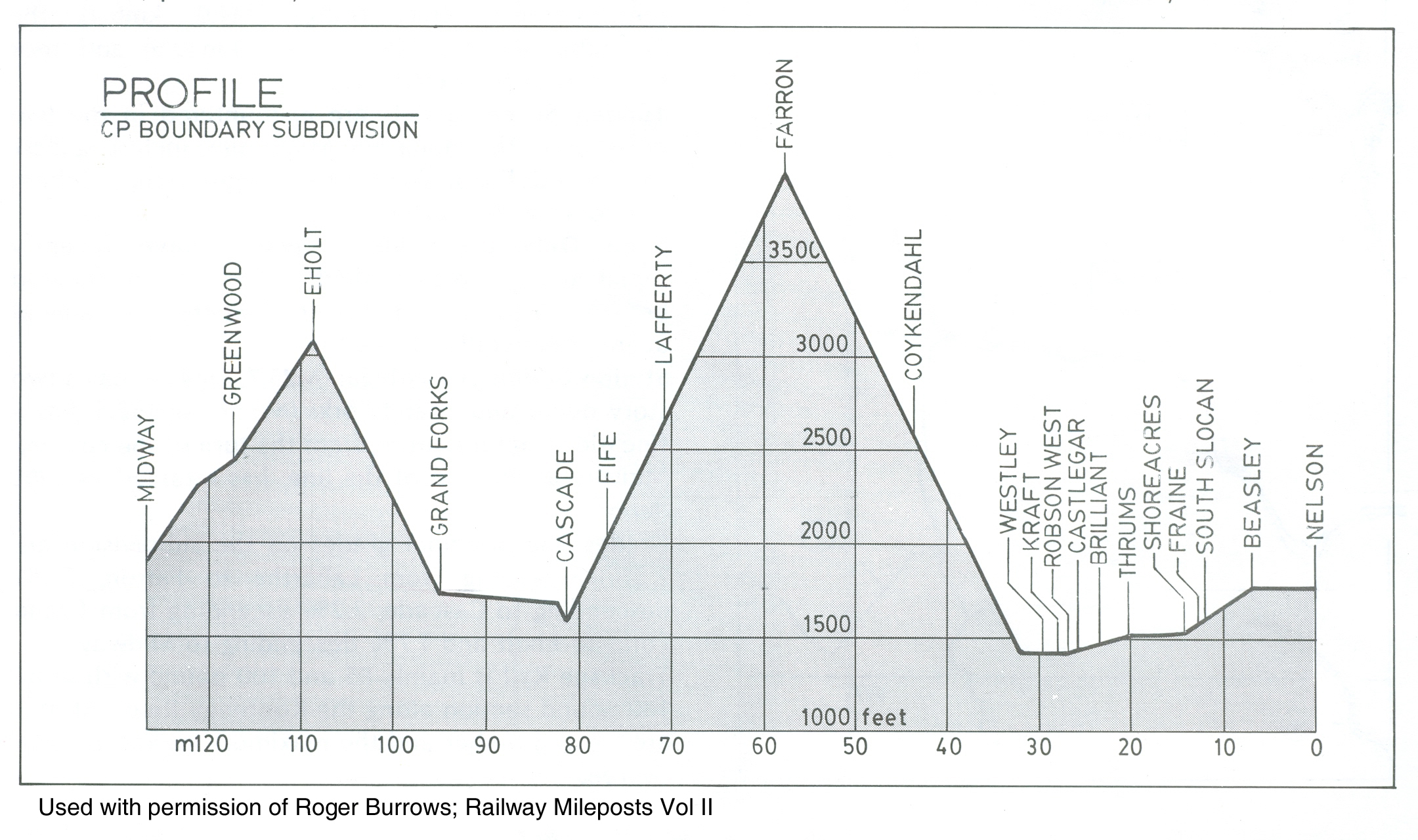
Boundary sub PROTOTYPE profile
-
Boundary sub Condensed Chart (Click to Enlarge)
-
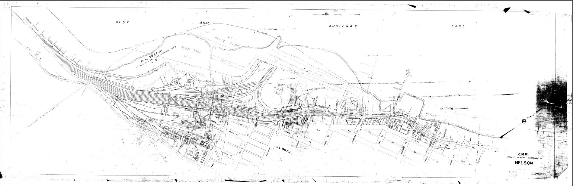
Nelson, BC (Mi. 0.0) - Yard Plan
-
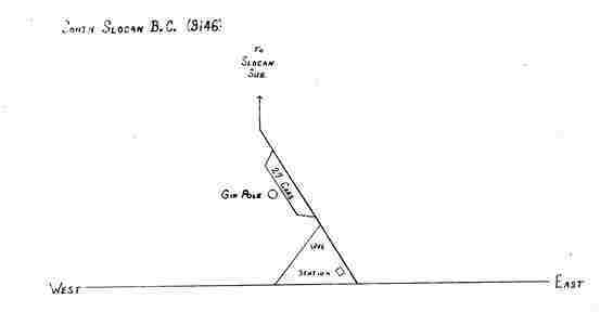
South Slocan, BC (Mi. 11.9) - Stationary schematic
-
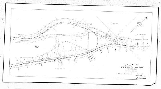
South Slocan, BC (Mi. 11.9) - Station Ground Plan
-
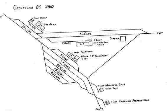
Castlegar, BC (Mi. 25.7) - Stationary schematic
-
Castlegar, BC (Mi. 25.7) - Station Ground Plan
-
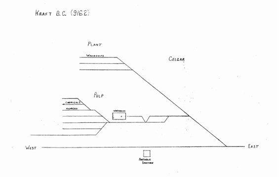
Kraft, BC (Mi. 28.0) - Stationary schematic
-
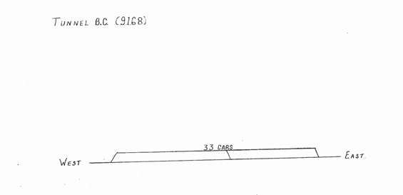
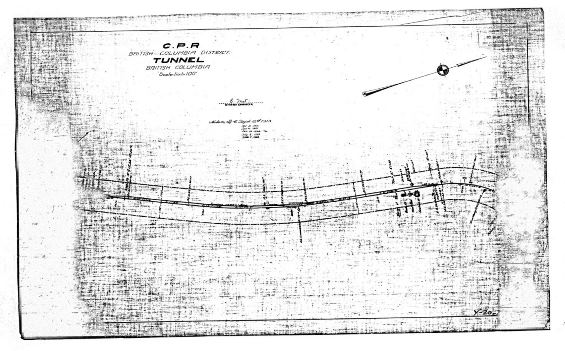
Tunnel, BC (Mi. 40.4) - Stationary schematic
-
Tunnel, BC (Mi. 40.4) - Station Ground Plan
-
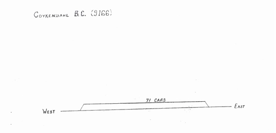
Coykendahl, BC (Mi. 43.5) - Stationary schematic
-
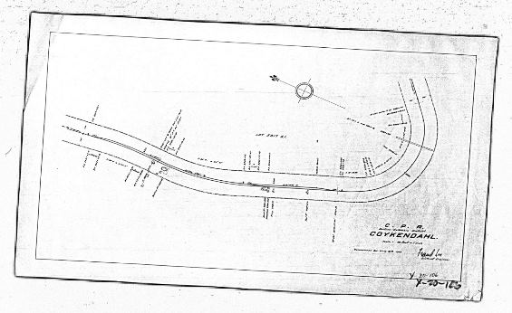
Coykendahl, BC (Mi. 43.5) - Station Ground Plan
-
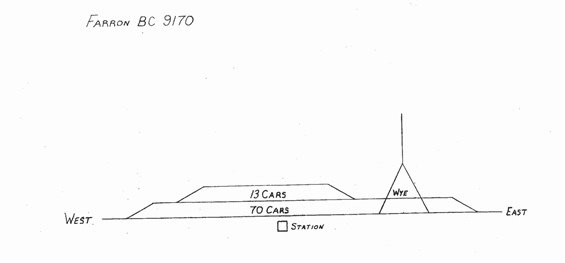
Farron, BC (Mi.57.8) - Stationary schematic
-
Farron, BC (Mi.57.8) - Station Ground Plan
-
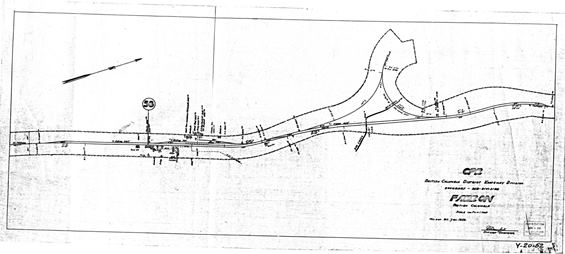
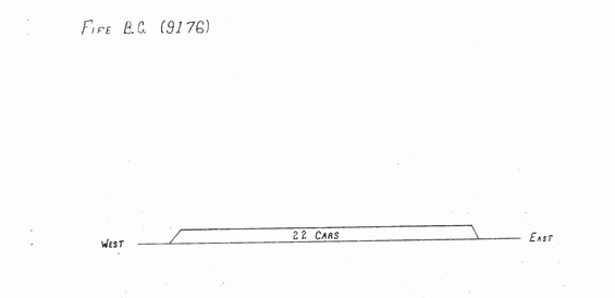
Fife, BC (Mi. 76.8) - Stationary schematic
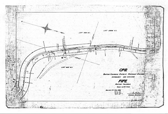
Fife, BC (Mi. 76.8) - Station Ground Plan
-
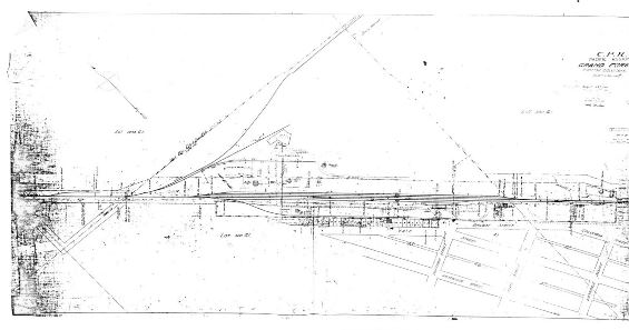
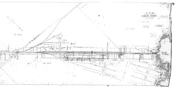
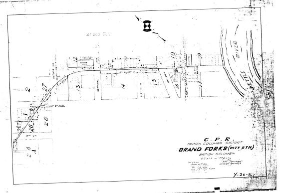
Grand Forks, BC (Mi. 94.8) - Stationary schematic
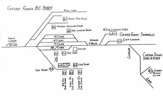
Grand Forks, BC (Mi. 94.8) - Station Ground Plans
-
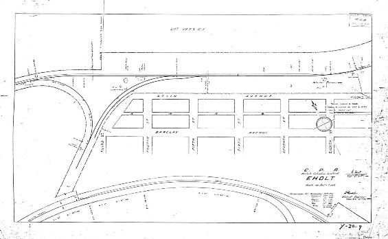
Eholt, BC (Mi. 108.8) - Stationary schematic
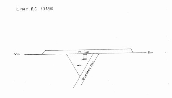
Eholt, BC (Mi. 108.8) - Station Ground Plan
-
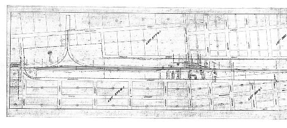
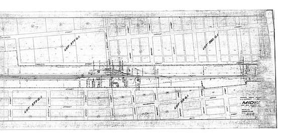
Midway, BC (Mi. 126.6) - Stationary schematic
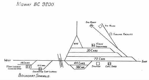
Midway, BC (Mi. 126.6) - Station Ground Plans
Boundary Sub Abandonment Document
-
On October 7, 1987, Canadian Pacific Limited (hereinafter CP) applied to the Railway Transport committee (hereinafter RTC) of the Canadian Transport Commission for authority to abandon the operation of the portion of the Boundary Subdivision from a point near Robson West (mileage 30.7) to Midway (mileage 126.6) including the Carson and Carmi Spurs (hereinafter the branch line), a total distance of100.3 miles, in the Province of British Columbia.

Click on the PDF icon to view the complete government letter.